Some of the key features of this event are:
- Ulladulla (New South Wales South Coast) – 224 mm of rain falling within a 24 hour period between Tuesday and Wednesday coupled with wind gusts that topped 100 km/h.
- A peak wind gust to 130 km/h recorded at Wattamolla Wednesday morning.
- Across parts of Sydney, peak wind gusts topped 100 km/h.
- Peak waves topped 12.3 metres at Batemans Bay.
Perhaps the strongest east coast low since July 2022, the storm event has certainly left its mark. Prior to the event, weather models were struggling in terms of its impact and amount of rainfall that could occur at any specific location. Generally, it was expected that a significant weather event would impact the coast Tuesday and Wednesday but its impact was difficult to predict.
For example, the attached GFS rainfall plot taken prior to the event suggested that the heaviest rainfall would occur north of Sydney and focussed largely upon the lower Hunter Valley.
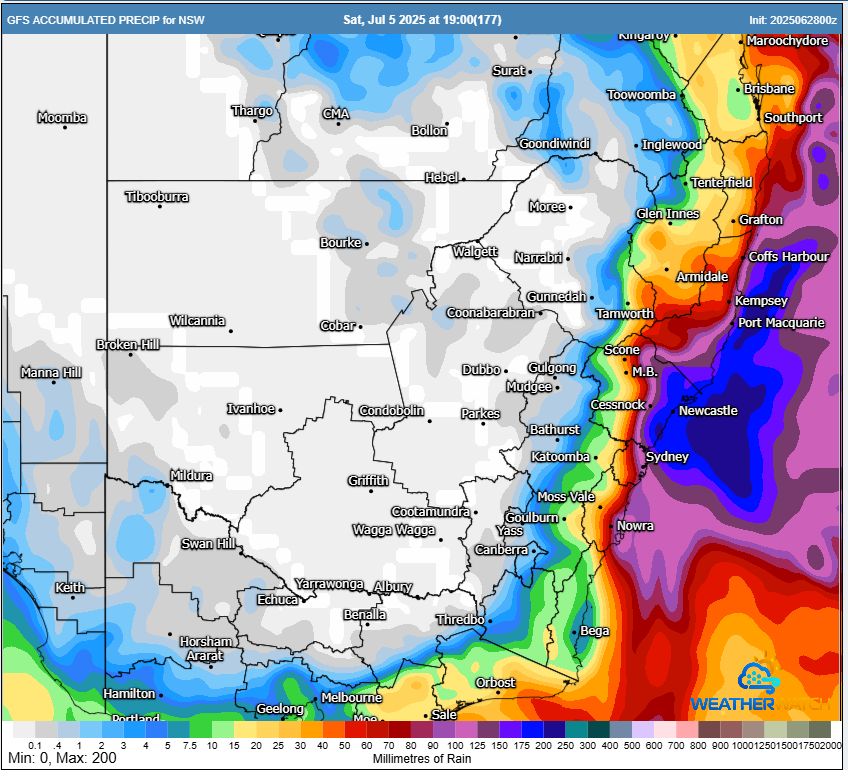
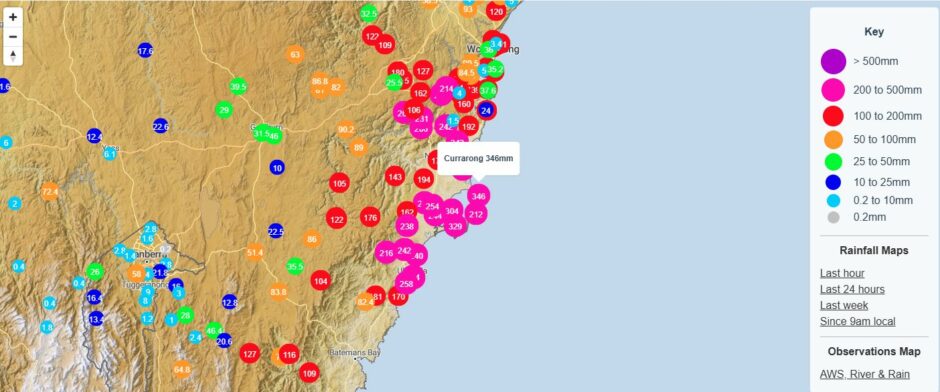
However, this was not the case because the heaviest rainfall totals occurred south of Sydney focused between Wollongong and Batemans Bay with significant impacts around Ulladulla. Various models were considered but all suggested different outcomes.
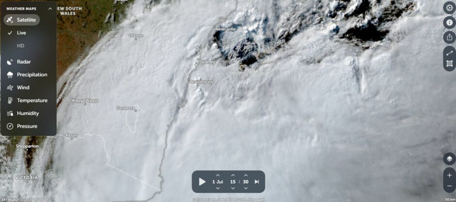
The storm system developed off the New South Wales lower north coast during Monday, overnight Monday and into Tuesday morning within 100 to 200 km of the coast making this a true east coast low. This became an intense system and while it brought rain to the Hunter Valley and the north coast, falls were not excessive in total.
Monday night and Tuesday morning, showers across Sydney increased to rain periods but interestingly, final rainfall totals for the event were not excessive when compared to historic events.
This event is significant for its wind gusts and significant and sustained winds were recorded right across Sydnery throughout Tuesday and into early Wednesday.
It is known that tree damage occurred and trees were felled including one that fell at Westmead Public School.
By Wednesday, the rainfall eased across Sydney and by Thursday, the event was largely over as the system moved southeast away from the coastline.
There is significant damage and emergency services attended at least 5,000 incidents.
Powerful waves whipped up by the storm has resulted in beach erosion with waves reaching as high as 12.3 metres at Batemans Bay.
Some important feature to note are:
- The heaviest rainfall totals were along the coastal strip of the state.
- Across Western Sydney, winds were often south to south west then southerly rather than south easterly (At the surface) but higher up, winds were more southeast. This is a feature that I have rarely seen occur. Despite the wind direction, reasonable rainfall still occurred but not excessive.
- The event was mostly coastal in nature and rainfall did not penetrate too far inland and barely crossing the Great Dividing Range.
Some key rainfall totals and wind events include:
Tuesday morning to 9 am
Rainfall
- Jervis Bay – 120 mm.
- Currarong – 101 mm.
- Vincentia – 84 mm.
- Point Perpendicular – 80 mm.
Note: The highest rainfall totals were limited to the exposed coastline.
Wind gusts
- Shellharbour – 91 km/h at 6.21 pm.
- Ulladulla – 85 km/h at 4.47 pm.
Wednesday morning to 9 am
Rainfall
- Ulladulla – 224 mm.
- Fitzroy Falls Dam – 218.5 mm.
- Roberton – 211.8 mm.
- Bawley Point Road – 207 mm.
- Nowra – 157 mm.
- Moruya 147.2 mm.
Note: The 100 to 200 mm totals are limited to small areas from Moruya north to Wollongong but not every locality had such totals.
Wind gusts
- Wattamolla – 130 km/h at 5.39 am.
- Montague Island – 120 km/h at 10 pm Tuesday night followed by numerous gusts between 100 and 119 km/h throughout the event.
- Port Botany – 117 km/h at 5.50 am.
- Penrith Lakes – 104 km/h Tuesday evening.
- Ulladulla – 100 km/h at 5 am.
Across Sydney, rainfall varied between 29 mm west of Richmond to 99 mm at Little Bay including 61 mm at Campbelltown and 85 mm at Homebush.
Thursday morning to 9 am
The weather system loosened its grip along the south coast and conditions eased fairly quickly. Rainfall was much lower with the highest totals only reaching 75 mm at Currarang and 66.6 mm at Point Perpendicular.
Some of the rainfall penetrated into the East Gippsland (Victoria) but the highest totals were only 73.4 mm at Chandlers Creek (73.4 mm) and Buldah (57.2 mm).
As usual with such events, a cleanup is definitely required due to fallen trees, flooding, beach erosion and damaged electricity networks.
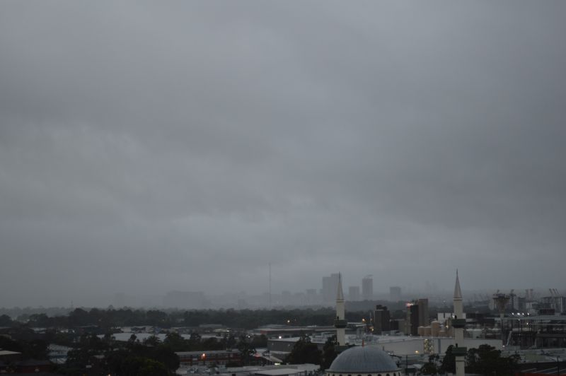
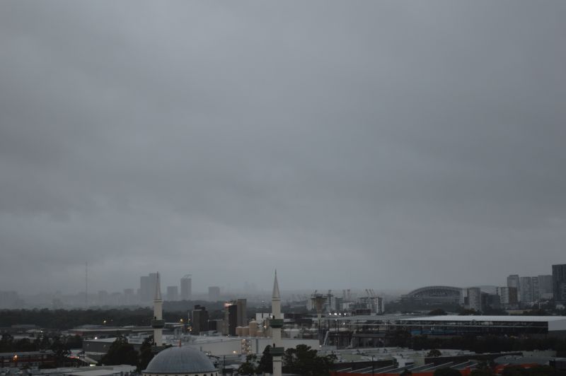
I have attached two images taken at sunrise Wednesday morning at Auburn showing rainfall easing across Sydney as the weather system is starting to move away from the coast. After sunrise Wednesday morning, conditions started to ease across the city.