https://www.extremestorms.com.au/storms-and-storm-chase-outer-western-sydney-monday-14-october-2024/
An interesting weather event spanning 5 days has just concluded for a large region of the Australian continent. During the period 14 to the 18 October 2024, thunderstorms have occurred somewhere across southern and eastern Australia with large areas experiencing at least 1 day where a thunderstorm has occurred.
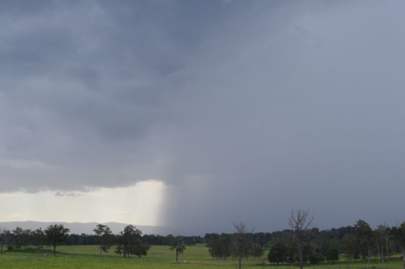
In the case for Sydney, this occurred mainly during Monday afternoon which was the subject of a storm chase. The link to the Monday event is attached above. I have attached additional photos showcasing the event to the current post.


Notwithstanding the Monday afternoon event across Sydney, there were:
- Thunderstorm events across parts of southeast Queensland on Tuesday.
- A very isolated event around Casterton during the afternoon and evening of the 16 October.
- Thunderstorm events across parts of South Australia and into far western New South Wales during the 16 and 17 October that produced damaging wind gusts.
- A broad event that passed rapidly east across New South Wales and Victoria during Friday that came with a strong southwest wind change.
The most notable events are summarized below.
Casterton – Late afternoon and evening of the 16 October
It would appear that a very isolated supercell thunderstorm impacted the town of Casterton in southwestern Victoria during the late afternoon early evening of the 16th. I have seen photos and images on social media of an intense and structured thunderstorm during the time including images of large hail (At least 5 cm in size).
The storm has passed over the local weather station and thus there are some official recordings of it that coincides with an intense storm including:
- Peak wind gusts of 87 km/h during a 4 minute period between 5.29 pm and 5.33 pm.
- Intense rainfall of 21.8 mm falling between 5 pm and 5.33 pm which includes individual bursts of 7.2 mm falling within a 3 minute period between 5.26 and 5.29 pm. This slightly exceeds a rain rate of 2 mm per minute at peak intensity.
South Australia – Wednesday and Thursday of the 16 and 17 October
Thunderstorms impacted portions of South Australia during the evening of the 16th. A particular thunderstorm has crossed into far western New South Wales and passed south of the town of Broken Hill toppling a major electricity tower that could take 2 weeks to repair.
Given that the storm passed over an area not covered by a weather station, there is no record of any peak wind gusts.
What is known is that several thunderstorms forming during Thursday brought some powerful wind gusts to locations that usually do not see such thunderstorm activity.
These include (All from individual thunderstorms):
- Tarcoola – Peak wind gust of 113 km/h between 5.56 pm and 6 pm. Further, it reached 42.4C at 3 pm and at 5.45pm, the temperature was 40.4C. The thunderstorm that passed through 11 minutes later dropped the temperature to 23C including a few mm of rainfall. The storm was brief but intense.
- Olympic Dam (Roxby Downs) – Peak wind gust to 111 km/h between 6.51 pm and 7.01 pm. This event came shortly after an earlier thunderstorm brought powerful wind gusts of 130 km/h between 5.56 pm and 6 pm. Thus, the area experienced two damaging events during a one hour period.
- Woomera – Peak wind gust to 106 km/h between 6.05 pm and 6.11 pm.
- Whyalla – Peak wind gust to 102 km/h at 6.59 pm.
Victoria and New South Wales – Friday 18 October
The rain band event that spread east across northern Victoria overnight and into early Friday morning is described as being quite rare. The rain band crossed the entire state (West to east) and thus solid falls eventuated all the way from Mildura to the ranges of North East Victoria.
The rain fell within an area that has experienced a relatively dry year. For centres such as Mildura, this was the best rainfall all year. In some respects, the Mallee and Wimmera regions of northwest Victoria experienced the best rainfall. Falls included:
- Woomelang – 56 mm.
- Marlbed Comparison – 52 mm.
- Walpeup – 43 mm.
- Ultima – 39 mm.
- Swan Hill – 35 mm.
This was mainly a rain band that spread east early Friday morning. Such falls spread to northeast Victoria which included 42 mm at Mt Buffalo Chalet and 26 mm at Albury Airport.
The thunderstorms of the day developed later on. A storm chase was considered but a number of concerns were raised with the weather models. A weather model that I observed suggested that storms would be traveling between 45 and 55 knots (Up to 90 to 100 km/h) which would make any storm chase difficult to undertake given the road network that exists.
No storm chase was undertaken as a result. As it was, most of the storms that formed, moved rapidly east. They were dropping short sharp rain showers and several formed part of narrow squall lines.


Rainfall figures were not high from the event with some of the better totals being across the inland southern New South Wales. This included 15.4 mm at Albury Airport but this fell from two or three separate thunderstorms that passed over the area.
The system came through Western Sydney near or after dark. By this stage, a few showers fell. I observed no lightning flashes from the event and for the most part, rainfall totals were light.
Melbourne and Geelong (Southern Victoria)
A separate event occurred around Melbourne and Geelong during Friday afternoon and some rainfall totals were quite high leading to some localized flooding. Some totals include:
- Geelong – 69.2 mm.
- Moolap – 57 mm.
- Coldstream – 40.4 mm.
- Sheoaks – 40.2 mm.
- Tullamarine Airport – 38 mm.
- Melbourne – 32.4 mm.
Certainly, the storms were hit and miss but for the most part, most regions across the south and east saw something during the past 5 days. Conditions have now settled.
The attachments provided show the storms passing across New South Wales during the period 2 pm and 5 pm and it is clearly seen that squall lines dominated the event.