During the weekend of the 12 and 13 November 2022, a significant weather event brought rain, storms and major flooding to many regions across Victoria and New South Wales.
This was a damaging weather event and moderate to major flooding occurred at:
- Albury / Wodonga including various towns westward along the Murray River.
- Forbes and various towns along the Lachlan River.
- Wagga Wagga and areas along the Murrumbidgee River.
- Bathurst
The town of Forbes which has approximately 8,000 residents was cut off and the shopping area of the town at one stage became an island surrounded by flood waters. Travel to the town is almost impossible.
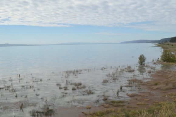
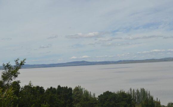
Lake George between Goulburn and Canberra unusually full from the rainfall
The evidence of this event and recent events was clearly visible during my trip to Canberra on Saturday 19 November 2022 where numerous trees were seen on the ground at numerous locations, roads were seen as being damaged and evidence of flooding was all too visible along creeks and streams.
Perhaps the most visible clue of this event and recent rain events is at Lake George which is full. This is an ephemeral lake which is only 6 metres deep at the deepest point and averages a depth of only 2.5 metres.


This shallow lake between Goulburn and Canberra only fills from rainfall. Runoff from the rainfall enters the lake via 5 creeks / streams and the lake has no outlet. The lake dries out during a hot dry summer but fills only during a wet period (Source Australian Geographic Nov / Dec 2020 Edition 159)
As shown in my photos, the lake is currently full due to the amount of rainfall that has fallen within the Goulburn / Canberra region especially within the past 4 months.
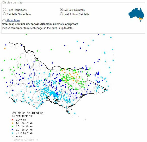
Intense storms and heavy rainfall during the period drenched an already flooded region. Some significant rainfall from this event includes:
To 9 am Sunday morning
Wagga Wagga - 75 mm (Note - A storm Saturday afternoon dropped up to 68 mm and brought winds to 83 km/h with Forrest Hill heavily impacted. The weather station recorded this but may have been damaged at the time. The station was unable to record the rainfall from the second event Sunday and as such, the final rainfall tally from the event and for 2022 will now be in doubt).
- Yarrawonga - 51 mm.
- Albury - 41 mm (This weather station is now recording some irregular rainfall patterns. While 87 mm fell from the 2 day event, rainfall for 2022 to date has exceeded 1,210 mm including 160 mm between November 1 and November 15. Major flooding occurred at Bandiana and along the Kiewa River including 2 known flood rescues. Perhaps the most significant feature is that rainfall for spring topped 500 mm).
- Swan Hill - 34 mm.
Parts of North East Victoria was also drenched with falls of 60 to 70 mm occurring including Archerton 69 mm, Tallandoon 68 mm and Mt Hotham 61 mm.

This contributed to increased flooding along various streams flowing into the Murray.
To 9 am Monday morning
- Canowindra - 120 mm.
- Walli (SE of Canowindra) - 120 mm.
- Forbes - 118 mm.
- Tuena - 116 mm.
- Borenore - 104 mm.
- Orange City and immediate region - Between 83 and 99 mm.
Despite the impact of this and the flooding caused Sunday and into Monday morning, the above figures were exceeded by an isolated total of 177 mm at Woomargama Post Office (South west of Holbrook - New South Wales).
Other strong totals include:
- Bathurst - 86 mm.
- Condobolin - 73 mm.
- Narribri - 67 mm.
- Coleambally - 66 mm.
The heavy rainfall passed over Sydney between 1 am and 4 am Monday morning where substantial rainfall of between 19 and 47 mm fell. The heaviest total of 47 mm fell at Holsworthy Training Area and falls of 25 to 30 mm were common. All rainfall cleared after sunrise.
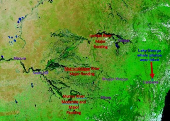
The attached image at the top of this post taken by NASA (MODIS) on the TERRA satellite shows the flooding in detail. With so many roads impacted, this is becoming the only way to show the true scale of the New South Wales flood crises.
- To the south, moderate and major flooding is observed from Albury all the way to Mildura along the Murray River.
- Major flooding is observed along the lower reaches of the Murrumbidgee River.
- Major flooding is observed across the Central West centred on Forbes.
- Major flooding is observed across the Darling River and Tributaries across northern and western New South Wales.
A marked up plot of the NASA image is also attached with major locations added being those areas that have been making the nightly news from this event.

- Australian Geographic Nov / Dec 2020 Edition 159 (Page 29)).
- Bureau of Meteorology for the rainfall figures.
- NASA (For satellite image of the flood affected region of New South Wales).
Photos of Lake George for this post were taken Saturday 19 November 2022.
