The 2024 hurricane season is expected to be significant for North America which commenced on June 1 and finishes on November 30. Between 17 and 25 storms are expected to be named with at least 13 of those being hurricanes including 4 significant hurricane events.
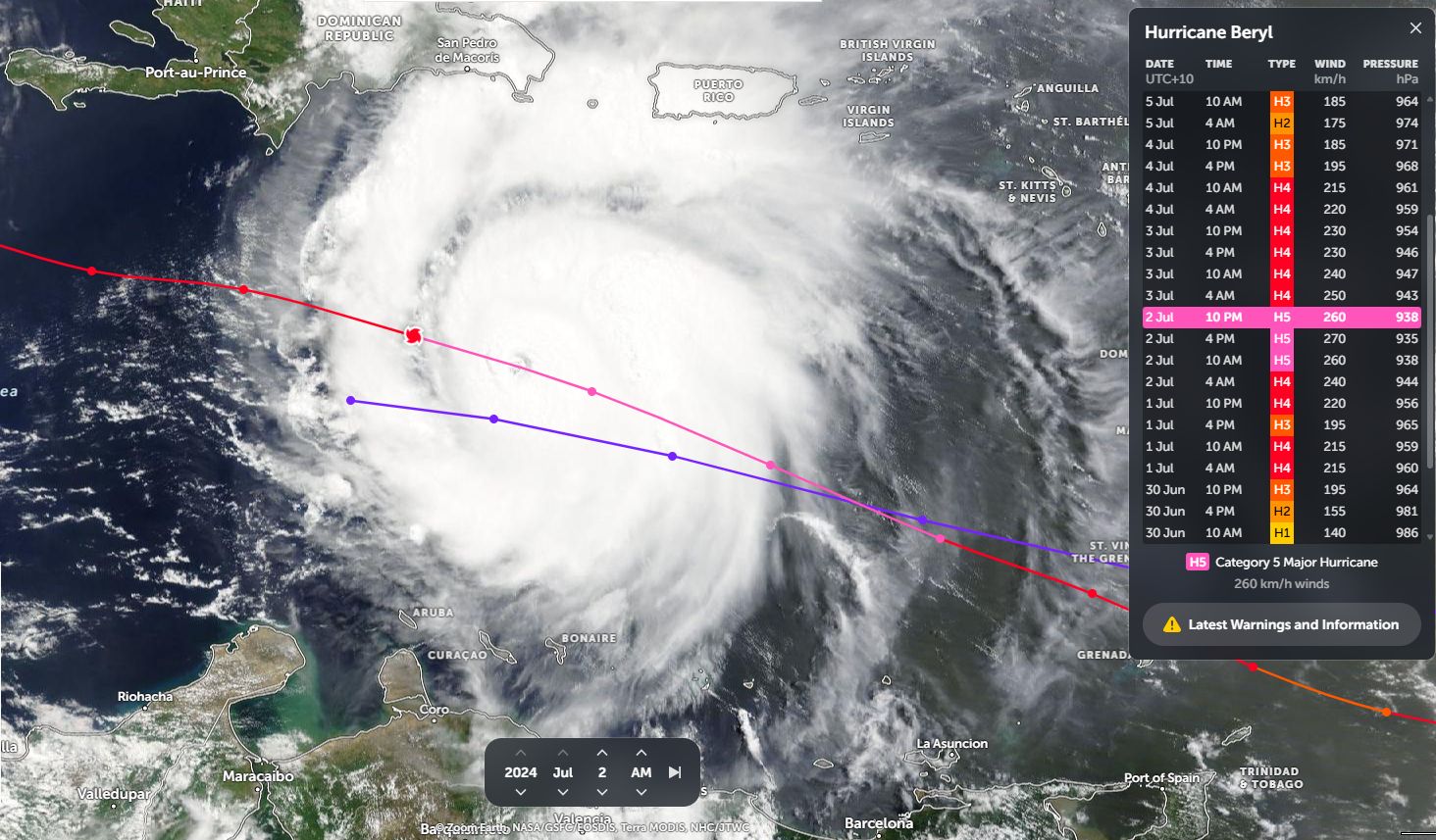
Hurricane Beryl has become the first major event for the new season. Further, the storm has been awarded the earliest Category 4 storm to be recorded for the region. As shown in the satellite pictures and associated graphics (Zoom Earth NASA 2024), the storm reached Category 5 on the Saffir Simpson Scale at peak intensity with winds at the core peaking at around 270 km/h.
The storm sustained peak intensity for approximately 18 hours between 10 am 2 July and 4 am 3 July 2024 with peak winds of between 250 and 270 km/h during this period at the core.
The storm generally formed over waters heated to 29C across that region and formed from a tropical disturbance to a hurricane in less than 42 hours. Further, the storm went from “Tropical Storm” rating to a Category 1 system in a space of 18 hours between 10 am 29 June and 4 am 30 June 2024 which is incredibly fast.
Fortunately, the storm stayed far enough away from major cities and population centres at peak intensity. It reached Category 4 on July 1, passed over Carriacou Island (Part of the St Vincent and Granadines) late morning 1 July causing significant damage across the island.
The eye of the storm later clipped the southern coastline of Jamaica as a Category 4 storm with winds at the core of at least 215 to 220 km/h. West of Jamaica, the storm went into a weakening phase.

Fortunately, the storm has now lost considerable strength and has now passed over the Yucatan Peninsula (Mexico) and is now downgraded to a strong tropical storm just below a Category 1 system on the Saffir Simpson Scale. It is possible that the storm may re intensify again before landfall to a Category 1 system near the coastal city of Corpus Christi (Texas) but overall, the storm has lost much of its earlier strength.
It is likely that once final landfall occurs near Corpus Christi (Southern Texas) Tuesday morning, flooding rains, thunderstorms and gales to 130 – 150 km/h will be the primary feature that occurs.