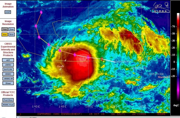
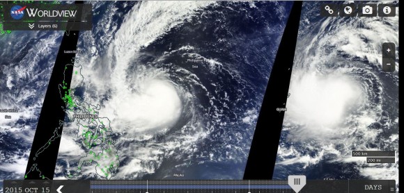
After a short period of relative calm, two tropical storms are forming concurrently over the north west Pacific Ocean, one of which is forecast by CIMSS to make landfall over Luzon Island (Philippines) as a Category 3 typhoon.
Both storms are forming rapidly within favourable environments and expected to transition into typhoons within twenty four hours. Both are now named storms as follows.
1 - Tropical storm / Typhoon Koppu (Named "Lando" by PAGASA)
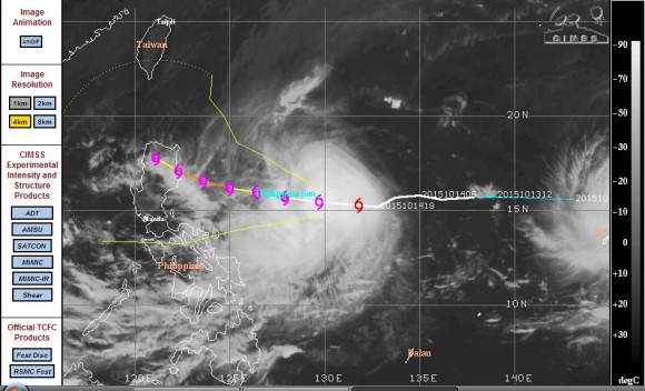
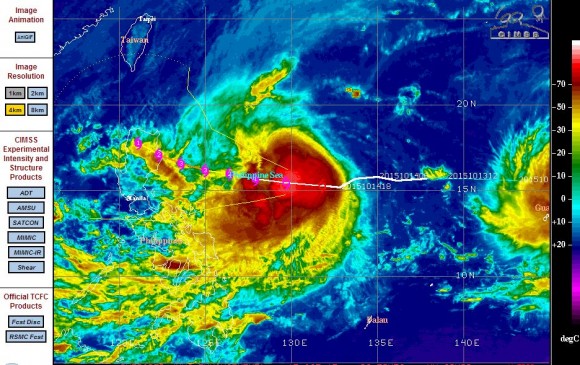
This storm is moving west towards Luzon Island at 17km/h with the CIMSS forecast cone showing probable landfall over northern Luzon Island as a Category 3 typhoon within 48 to 72 hours. The storm is already sustaining winds of 50 knots (Approximately 93 km/h) with gusts to 65 knots (Approximately 120 km/h). The storm is already making the transition to a Category 1 typhoon. Should the storm maintain its course, it would track over a substantial portion of northern Luzon Island and there is potential of a weather related event especially heavy rain, winds and flooding. The forecast model shows a Category 3 storm with winds of 110 knots (Approximately 205 km/h) prior to any landfall.
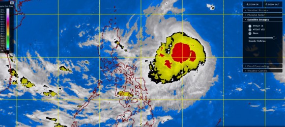
A number of warnings have been issued by PAGASA (Philippine Atmospheric Geophysical Services Administration) for shipping, gales and heavy rain as the storm approaches northern Luzon Island.
2 - Tropical storm / Typhoon Champi
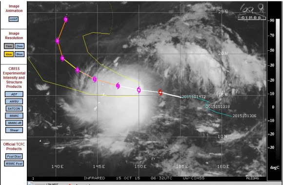
This storm is forming close to the Mariana Islands and Guam and is expected to transition to a Category 1 typhoon within twenty four hours. The storm is also forecast to reach Category 3 status within 72 hours with potential for maximum wind speeds of 110 knots or 205 km/h.
The storm is expected to pass over the Mariana Islands as a Category 1 typhoon but at least the storm is forecast by CIMSS to take another path and remain over open ocean for most or all of its life span.
Satellite images
The satellite photos of the area show the storms close together and both are active systems. Both storms are forming within a favourable environment where sea surface temperatures reach 29C to 30C.
A close up view of the satellite photos show strong convection for both storms but no eye feature. It would be expected that an eye will form within both storms as they make the final transition to typhoons.
The next few days will be tense for the residents of northern Luzon Island as they could potentially endure another major storm event for 2015.
CREDITS
1 - NASA (MODIS) Worldview with overlays for the satellite picture acquired 15/10/2015.
2 - CIMSS for the satellite images of both storms acquired 15/10/2015.
3 - PAGASA for the satellite image of the storm off the coast of Luzon Island dated 15/10/2015.

