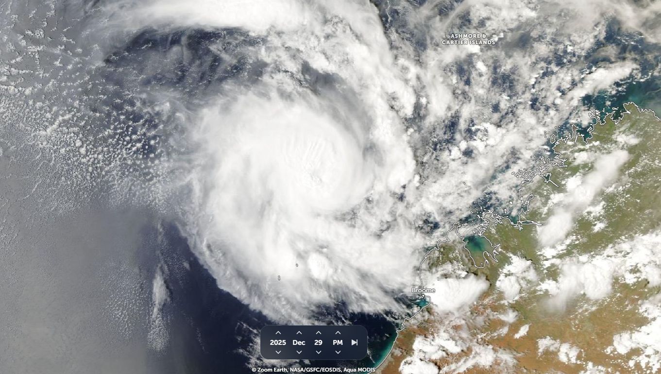
While I was in Indonesia, I became aware of a tropical cyclone named as “Hayley” which formed from a cluster of thunderstorms during the 28 December approximately 700 km north northwest of Broome. The storm made landfall on the Dampier Peninsula north of Broome (Western Australia) on the 31 December 2025.
The storm was short lived but appeared to briefly reach Category 3 on the Saffir Simpson Scale whilst still at sea with peak winds at the core of at least 238 km/h.
It is also suggested by the Bureau of Meteorology that the storm briefly reached Category 4 on the Australian Tropical Cyclone Intensity Scale 1989 with peak winds of 230 km/h at the core at peak intensity. This is still subject to verification as peak intensity occurred over open waters with no weather stations available to confirm what occurred during its most intense phase.
The system made landfall over the Dampier Peninsula north of Broome but weakened prior to landfall. As usual with such storms, the storm rapidly weakened upon landfall.
Landfall occurred close to a few isolated communities of Djarindjin and Lombadinda.
The storm caused minor damage across the region.
The region is mostly remote and sparsely populated. Further, weather stations across this part of Australia are limited in number.
A weather station at Lambadina is the only available monitoring station that recorded anything significant from the storm in terms of peak wind gusts. A peak wind gust to 157 km/h was recorded here on the 30 December and the same weather station recorded 131.8 mm of rainfall to 9 am 31 December.

A rainfall figure of 182.2 mm was recorded at Lansdowne to 9 am on January 1 2026 as the remnants of the storm moved further inland and weakened.
I attached an image of the storm from Zoom Earth just prior to landfall.