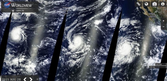
With the demise of Typhoons Atsani and Goni across the north west Pacific Ocean over recent days, attention now focuses on three named storms in waters within the vicinity of Hawaii and Mexico, one of which appears to be a threat to Hawaii.
All three storms are new hurricanes and all three are within favourable environments that will support such storms. From east to west, the named storms or hurricanes are:-
1 - Hurricane Jimena.
2 - Hurricane Ignacio.
3 - Hurricane Kilo.
The spectacular MODIS Worldview showing the waters surrounding Hawaii and Mexico shows all three storms aligned (Image acquired from NASA 29/8/15 with overlays). A brief discussion of each hurricane is provided.
1 - Hurricane Jimena
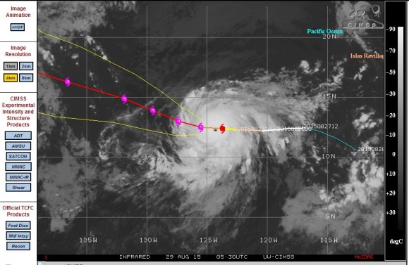
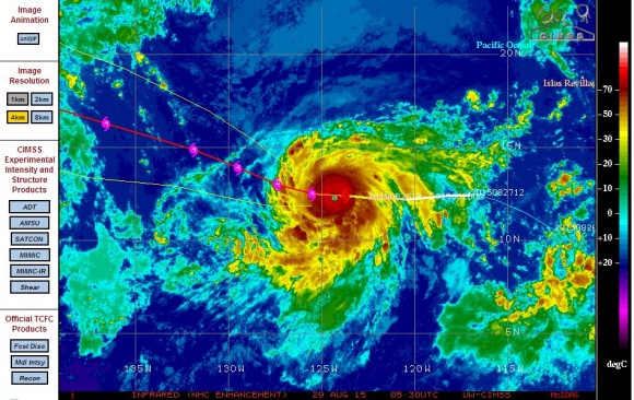
The easternmost hurricane is a powerful Category 3 storm sustaining winds of 105 knots (Approximately 194 km/h) but is expected to intensify to a Category 4 storm and possibly approach a Category 5 storm given its current environment. The storm is expected to sustain winds of 135 knots (Approximately 250 km/h) in coming days partly due to its passage over waters of 30C and low shear.
The storm has a well defined eye and is expected to be the fourth major storm of the season in this part of the Pacific Ocean. Forecast models indicate slow decay after 48 hours. The storm should not threaten any land or population centre and hence its entire life span should be over open ocean.
At the time of writing, the storm is located 12.4 degrees north and 123.7 degrees west and should track west before turning more north west.
2 - Hurricane Ignacio
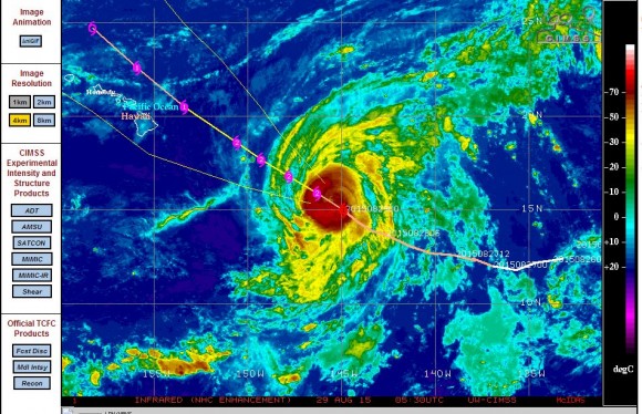
The hurricane centre to the MODIS Worldview image currently sustains winds at the core of approximately 80 knots (Approximately 148 km/h). The storm has been slow to develop and it is unclear why.
The storm is forecast to sustain winds of 90 knots (Approximately 167 km/h) within 24 hours and should reach a Category 2 storm in coming hours.
A research plane will be flying into the storm in coming hours to verify the strength of the storm and to ascertain what is occurring. The storm is expected to start to weaken after 48 hours.
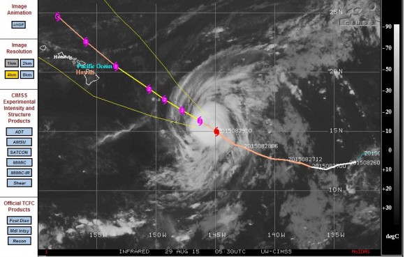
At the time of writing, the storm is located 15 degrees north and 144.9 degrees west and should track north west which would take it close to Hawaii. This storm is the storm to watch given its proximity to the Hawaiian Islands.
3 - Hurricane Kilo
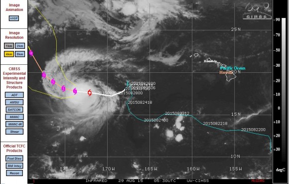
The storm has been slow to develop and is well to the west south west of Hawaii and currently not a threat to any population centre.
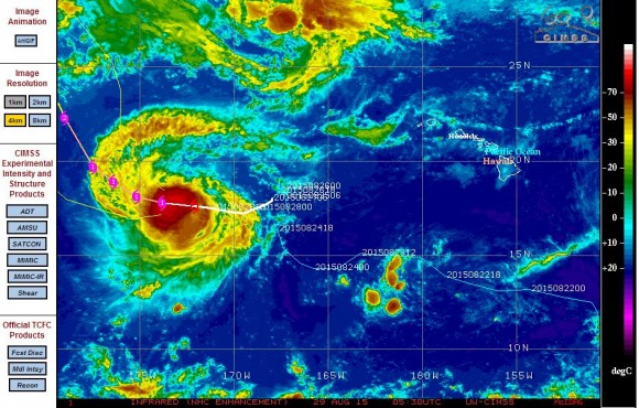
Winds at the centre are calculated at 60 to 65 knots (Approximately 111 to 120 km/h) which is effectively a hurricane. Given that an eye has just formed it is determined that this is a newly born hurricane. The storm will be passing over waters of 30 degrees and is expected to strengthen to a Category 2 storm within three days sustaining winds in excess of 90 knots (Approximately 167 km/h).
Forecast models suggest further strengthening out to 120 hours with winds of 100 knots (Approximately 185 km/h).
At the time of writing, the storm is located 17.8 degrees north and 173.8 degrees west and should track west before turning more north west.
The various CIMSS models for each storm is attached all of which are acquired on the 29 August 2015 from CIMSS.
This is now a very busy time for the National Weather Service regarding the formation of new hurricanes at the same time. It will be interesting to see what occurs with Hurricane Ignacio over coming days. Given that a research plane will be flying into the storm, this does suggest some level of concern is being raised given its proximity to Hawaii and expected movement close to the islands.

This is an interesting scenario because all three hurricanes have intensified and all three are category 4 storms which is rare to occur.
Hurricane Jimena:- This is a Category 4 storm which appears to have reached peak intensity with sustained wind reaching 120 knots (Approximately 222 km/h) at the core. The storm will slowly weaken as it tracks north west and encounters cooler waters.
Hurricane Ignacio:- It has been identified that the storm has reached Category 4 status. The storm is moving north west at 8 knots or approximately 15 km/h. Storm watches are likely to be required as it approaches Hawaii especially for the Big Island and Maui.
Hurricane Kilo:- This storm has reached a Category 4 storm and is expected to sustain peak winds of 130 knots (Approximately 241 km/h) at peak intensity.
The only storm that is a threat to any population centre is Hurricane Ignacio and it appears that warnings will soon be required due to its close proximity to Hawaii. However the storm will begin to weaken as it approaches the islands. All three storms are generally following the forecast paths but it is interesting to note that all three storms have similar intensity at the same time being Category 4 storms at peak intensity.