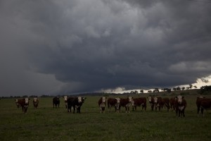
What a chase day! The forecast for this event was one of those difficult decisions - interrogating inconsistent models on the day trying to work out what was happening. Harley and I were even almost going to talk ourselves out of chasing! With a day off, we just decided to "check it out" - "what the heck". Check it out alright - 1200km later...
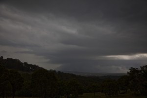
Targeting the region in the southern Northern Tablelands for storms that might venture across as the winds turned north westerly. Well storms of course decided to developed west of Scone! I felt bad because Harley had already suggested that was one of his targets. We continued on to our target and at least hoped that this cell headed for Scone would make it across the range. We could intercept it and any cells that may develop near it if it died. Well the infamous right mover anvil did it again - the first Scone cell died before even making it to Scone. So we decided to head for the mess heading for Tamworth. It was a mess up this point. To put things in perspective, straight distance wise we were only 100km from Tamworth. On the Great Plains, excellent viewing and awesome road network, we would have easily seen the structure within the time it had made it to Tamworth. For whatever reason, perhaps outflow or some local effect, the cell near Tamworth exploded and separated moving left of the of the mess of cells. And the day began. We could see most of the structure but not the base of the Tamworth cell - the hills just sufficiently annoying that we had to drive NNE to Walcha and then WNW towards the cell. But then I could see it happening, two cells developed to the north of the Tamworth cell. It would die before we even got a chance to see it. Based on the massive side anvil shield, I knew the Tamworth cell was not mucking around!
On approach to Woolbrook, we finally saw the structure! It was not the perfect position but it would have to do! We could see cow catcher and inflow bands. Lightning strobing out the empty separation between the mesocyclone and the hail precipitation core. The cell was not as strong as the explosive size at Tamworth but nicely structured! Finally rain began to fall from the cells encroaching us from the NW. We were about to experience a merger near Walcha. Which we did! Seeing a cell on radar behind this mess, we eventually headed towards Uralla, A nice anvil with impressive structure was unfolding but again, the low bases kept the main structure hidden. Finally, up close and personal, the beautiful wet classic structure similar to what we had observed from the "weaker" Tamworth cell revealed itself.
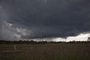 Timelapse was in order. I never felt the weight of the Manfrotto I can assure you. If I was on worker's comp, I would have been caught out on this day as I ran 40 metres through high grass to the fence line. One more problem - dumb f... cows! Get out of my way! I tried to shoo then off - to no avail! I could hear Harley laughing in the background.
The structure was beautiful, a nice separation and visual rotation was evident around the back side of the base! Lightning began to strobe from the anvil. But it was the rain that scared me due to the equipment. Another dash for the vehicle and we headed up the road. This position was not the best but had to do! The storm at this point was getting angry dropping bolts within a kilometre followed by crackling booms! Harley popped straight back in the car. Thanks buddy - now it was now clearly evident who had the highest probability of getting struck.
I hear a call from Harley, I don't want the car to get dented as the hail core encroached! With a false smile I said "No problems Harley". That metal smashing instinct can never be erased. We did clear the core in time. We came back but the storm I recall 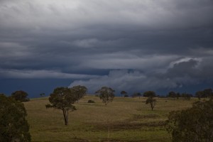 had gone into a weakening phase and the hail sizes were not large at all.
What remained now was mass of cells mostly developing near Tamworth! In the end, we decided it was time to head back home and see what would come through if required chase it. It this point our time of arrival would have been 11:30pm. A cell was coming through from Quirindi and only less than 40km from our position. We decided to just check it out. Bad move from a good night's sleep perspective! That single move updated the time of arrival for me to 1am!
But the structure and behaviour of this cell was incredible. We were at 1400 metres elevation so the moisture was streaming up to the base like the streaming fireworks off the Harbour Bridge in reverse. A powerful anvil ensured this storm meant business. More timelapse as its structure approached. The lightning at this point was persistent with a constant rumble from thunder intermittent loud crashing thunder echoing in this quiet sleepy neighbourhood! A black core occurs on radar. Although it was relatively linear, the storm still dumped hail to probably 2 to perhaps 3cm. A beautiful "plastic" shelf cloud preceded this barrage - obviously a local effect.
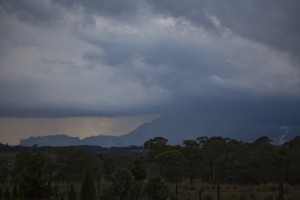
We left this location set for home. The lightning shots we could have captured were at times stunning but we had to head for home. I thank Harley for his patience and understanding on this matter - but unfortunately had no work today so we could have stayed there after all! We were content though from the afternoon's chasing. It was Harley's longest distance chase and I assisted in driving on the way home! Lightning strobing behind us at irregular intervals - similar to the clear lightning structure on Kane's photographs but from rear or side perspective!
Harley will write something once he recovers. It has been a relentless episode of chasing. What makes it more difficult is the return trip. But the pain is sure worth it. I owe Harley a steak! Anyone that wishes to join us on Friday feel free to do so. Perhaps we can exchange storm stories. Call me for details if you are interested or if there is a great steak place you know of.
To save some money on steak, should have taken hold of one of the cows from the paddock for ruining my timelapse!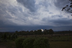
My phone number 0408020468.

Jimmy, thank you so much. This was the longest ever chase I have been involved with and we did drive at least 1,200 km and filling the car up three times, the most ever in one day. I have to admit, this was my greatest chase and wow, I really enjoyed it. If I had been by myself, I would have stayed the night probably at Walcha but I was conscious of Jimmy going to work Tuesday. Its my longest drive ever (Approximately 800 km) and too far for me to drive in one day (Blacktown to near Uralla and back). This was a great little team effort at a time when I did start to get driver fatigue especially after 800 km or so hence I needed some help.
We left at around 8.30 am and arrived back at 12.30 am Tuesday morning so it was a 20 hour chase across the southern New England Tableland. My photos are good although I have modified a few to make them even better or ominous.
I was thrilled to get two wall clouds. I have never done that before. We did get a hailstorm at the end with hail to 2.5 cm and possibly 3 cm. I saw one large stone fall and bounce some 3 metres from the car. I wanted to get out to find out how big it was but it proved to be so difficult with rain and hail dropping. I was excited to see supercell storms although I do need to be careful with large hail.
I did look at weather models early and I suggested the Scone region so I would not have been too far away. My concern for the mid north coast was that cloud mass and rain band so my cut off was a line north of Taree to probably Armidale. I looked at the stormcast models and it did show storms to fire in the Upper Hunter and lower New England region but not areas further north.
It would be great for a storm chase group get together for Friday evening as keep in mind, I took annual leave for this big storm event and have been chasing, watching clouds and getting storms since Sunday 25 November. This event concludes my big storm chase and has made my holiday really enjoyable and a success. I have concluded with a bang and not a wimper. I am looking forward to Friday and my steak.
Just of note, I have now experienced three hailstorms since early November.
That photo above is slightly modified to get a deep, dark and potent effect of that supercell that went through Tamworth. The wall cloud is visible. I did this to make the wall cloud more potent and to give the effect of daytime turning to night.
The next photo is just south of Uralla. We are approximately 15 km south of Uralla. As I was taking these, I could hear Jimmy trying to get the cows out of the way. I was laughing but it is all part of the fun.
The storm approaches. I did see a close cloud to ground strike from this. I took my photos and sat in the car with the window down taking my photos. We are south of Uralla.
The next photos I would say are my favourite. The colourations, the contrasts are beautiful. This was the storm that we got the hail. Jimmy and I are near Nowendoc. I think we are facing west or south west.
My last photo is slightly modified to get that potent image of the oranges, the blacks and the contrasts. Once this storm passed over us and dropped its hail, it did start to weaken. There were other smaller cells in the area but we could not stay. Thank you to Jimmy for making this a fantastic day and great company as well.
Brilliant guys! I am so glad someone was up there for the storms. I would have targeted the Scone-Tamworth area this day too.. but I was stuck at work watching it on radar and dealing with the live interviews following the storm lol..
The hook exhibited on the Tamworth storm was remarkable. The right mover coming off the same band of storms that died as it hit Scone also looked very interesting.
Looks like a great storm. How big did the official hail size get for the Tamworth storm?
Thanks for the comments and radar posting. I can assure you we did not get the most intense part of the cell.
Ben, just a couple of questions out of curiousity, why would you have targeted the Scone and Tamworth areas? Which initial area – Scone or Tamworth. The initial dying cell near Scone would not have given anyone a chance to make it to the Tamworth cell in time if I recall?
Also, what were you anticipating for Tamworth and Scone – supercells? After all, winds were changing to a north westerly at Gunnedah and Tamworth and dewpoints dropping. The hodographs represented a un-idrectional atmosphere based on the models. Something occurred within the cluster of cells to enhance the low level flow helicities. Or was the storm’s explosiveness able to overcome at least briefly the tend towards outflow dominance. The bow echo segment east of Tamworth was testament to that. Of course, I do below the wind shear in the low to mid-levels were strong enough to produce rotating updrafts aloft.
I also noted that the Northern Tablelands did not experience the anticipated NW winds. I think one of the reasons for this is the lack of surface heating created by the massive anvil shield.
Regards,
Jimmy Deguara
Harley, your documentation of the event was excellent as usual!
Regards,
Jimmy Deguara
Posted images of the Tamworth event – well the event further to its east anyway. Will post some spectacular videos in the coming days.
I’ll post a bigger report tomorrow, but for the time being i’ll keep it brief. The initial plan was Glen Innis, however I made a foolish decision(it seemed sensible at the time) to chase the sunshine further north,and I actually ended up in Tenterfield. Bad move, as I was now in an area of lesser shear. explosive updrafts kept shooting up just east of town, forming pulse storms near Drake( horror chase country) I did not muck around for long ,and bolted south to Armidale, witnessing some weak storms with nice cgs on the way there… On evening I got onto a lovely LP storm near Uralla, I cringe using the word supercell, but it had that lovely tilted updaft and It was pumping out lovely lightning. I’ll call it an lp storm and leave it at that but it sure was beautiful…. Heres a video of it below, I hope it works!!!!
I was just thinking had Harley and I ventured up the road from Topdale region and headed for Tamworth from there. We may have seen from a distance the supercell at its peak – question is from the wrong side. So was it a better idea to head to Walcha and hope for the best? What if the storm had collapsed?
Does anyone recall how long it takes to do the road from Topdale Nowendoc Road to Tamworth via the road?
Ok I made a google map analysis and it seems to suggest about an hour to Tamworth from the Topdale Road turn-off and it would be estimated to be 47 minutes to get to the position we were in to get the final structure before the merger near Woolbrook. I think we may have well missed getting any of the structure had we gone the other way so perhaps a correct decision.
Just food for thought.
Good on you Michael for chasing on this day and I look forward to the video (just remember on Youtube, go to “share” and then press “embed” for the script and post it in your post. You obviously also targeted the Northern Tablelands region which to me was consistent with the models as it stood! The models got it wrong – see my comments above and changed the whole perspective of the chase.
I am pretty sure there were several supercells on the day but as to whether they were supercellular or not would really require radar analysis. David Croan suggests he saw couplets on both the Tamworth obvious supercell and the one that followed through to Woolbrook seemed to have a couplet. This went through what seems to be weakening and strengthening phases on radar – not sure if there are any attentuation issues here – well it is on the edge of the 128km radius radar at this point.
Hi Jimmy,
I was certainly expecting some supercells on Monday somewhere in the region.. in my forecasts for the day a couple of days out (at WZ) suggested large hail,damaging winds for the area (although I did not anticipate cricket ball size hail). Mostly, the wind shear across the region was impressive throughout,including the jet, although as you said the turning was not overly amazing on the initial progs. Instability was also impressive and storms had fired from the Gunnedah region overnight.
However, progs suggested some sort of triple point convergence going on in the area, with a SE, NE and NW (can all be seen at the obs), and WZ’s live obs streamlines showed this quite well, with storms forming on the boundary of this convergence. I am only recently learning about the importance of convergence triggering storms, a similar thing was seen on the CT’s storms last Wednesday (as well as on Sunday), storms exploded on the convergence boundary.
As you said though, had one originally targetted the original Scone cell, the Tamworth cell would have been missed, although the right mover would have been able to be been gotten easily. Re the couplets yes I noticed a few.. there was one briefly on that original Scone cell too. Storms seemed to die near Scone as they hit the SE wind.
Hi Ben,
Sounds interesting regarding the data from Weatherzone. Are they nowcasting maps or prediction models? Can you post a sample here thanks.
Regards,
Jimmy Deguara
Here is a video of the second cell of the day. Can we safely say this is rotating? This is sped up at 8X
This is my video from Uralla.
Awesome description of events you and Harley observed Jimmy – you have a knack of describing storms!
The video made me laugh – the damn cows look like they were ganging up on you :)
I was not joking around -I seriously attempted to shoo them off at least 2 or 3 times.
The second storm a little further north becoming angry.
This may be the early stages of the storm I photographed from Sawtell?
http://www.extremestorms.com.au/2012/12/04/north-east-nsw-severe-storms-3rd-december-2012/
Looks to be rotating to me
Hi Mike,
The storm with lightning was spectacular definitely an LP storm. Hard to tell whether the storm was rotating. But who cares, the lightning was awesome! It certainly would have help make your day.
Jimmy
Nice and artistic- this looks do mean!
Thankyou Jimmy and Kane!
Jimmy, yeah I’m not too sure either. Looking back at the radar, this storm had a tiny black core on the namoi radar but the storm didn’t last long at all,and tracked west to east, unlike some of the stronger and more organised storms which in a more E/NE direction..But yeah, it was a nice pick up following a day where some wrong decisions were made on my part.
Hello Kane. I am 100% certain this was not the storm you took photographs of… This storm died rapidly after that last CG in my video and never made it far past Woolbrook… but not before producing a spectacular little shelf cloud feature at the small base of the storm.. Once my storm died, I noted a storm 50kms to my east northeast which was flashing once a second. I suspect this was your storm.
It does look to be rotating so one can lean towards supercell. However, is this storm severe? It looks to be severe. Is the storm exhibiting obvious signs of supercell characteristics? I doubt giant hail during the period in these timelapse but I suspect large hailstones were likely.
Let’s assume we called it a supercell then what type of supercell will it fall under? Low topped – storms were achieving decent heights. Was it a mini- supercell? I would require to look at the parameters to see if this fits such an atmosphere.
All we can say from the video are the storm seems to be rotating and that it has a persistent updraft thoroughly all the videos. Radar seems to indicate a persistent core as well. I am likening this structure to the Penrith storm event in February.Colin had close up and personal shots of this…
Is this a wall cloud? It looks and behaves as such.
I look forward to David’s point of view.
Further to my first post, I have spent considerable time working my photos and some video film and now provide additional photos of this storm event. I have resized some, modified others and altered the colours.
The first photo shows the supercell base much closer to us. Taken 15 km south of Uralla looking north west as it approaches.
The second photo shows the storm after it has passed. The rain and hail shaft is clearly visible and well defined. This is now looking east as the storm is moving away.
The third photo shows a cloud to ground lightning flash. This is near Nowendoc looking north west. This storm was not strong but I managed to capture a single lightning strike.
While watching the storm (Near Nowendoc) approach us, I managed to capture this image. A small within cloud lightning flash set against the backdrop of its base. This is looking south west.
Finally, another image of the evening storm approaching us. I have enhanced the colourations. Looking west or south west. I have looked at my video film and unfortunately, I did not capture any cloud to ground lightning strikes from this cell.
Following on from my previous post. Heres the structure abit later in the storms life, when it was too dark to film( my video cameras dont handle low light well) The cloud feature at the base was a small shelf cloud..Hope the photo works.
Posted a couple of videos – would not mind others outside of extreme storms to voice their opinions on this and other storm events.
This storm looks to be rotating on the video. I was watching it while taking my photos and I began to wonder whether it was rotating or not. Looks like my suspicion may be answered. I am not sure what type of supercell to call it.
Whatever it is agreed upon, I thought that this storm was unusual. The base appeared to be close to the ground at one stage but appear to rise as it came towards us.
Even I noticed an interesting base. As I was driving away from the main rain core to escape whatever hail that would be within it, we did pass through a strengthening rain shower that began to fall from the rain free base.
Wierd shelf cloud forms – looks like a plastic sheet!
It was a little further down the road but yes I would suggest they would have scattered!
Ok guys, given I was not totally convinced, I have asked Gene Moore and I hope he does not mind me mentioning his view points. He does not think it is a true supercell which is what David Dave Croan and I suspected. I am trying to put it in some perspective as to what we have quite often in this country. Not all cases are true super cells.
An excellent discussion has been progressing on facebook on the nice looking storm and it is not ‘obvious’ this is a supercell. I will have to rename the video title! I now believe we got the storm when it was in break down even as nice as it looked
——————————————–
Jimmy Deguara shared a link.
Wednesday at 7:12pm ·
Wall cloud and supercell Part 2
http://www.youtube.com
Lightning became a problem as the storm approached very near. It was reasonably active. Note the storm separation eases towards the end.
Like · · Unfollow Post · Share
Harley Pearman, Storm Optix and Andrea Tritto like this.
Jimmy Deguara Do people think this is a supercell or not?
Wednesday at 10:15pm · Like
Nathan Morris Looks like a small left-mover on radar about 5-5:30pm in that area.
Wednesday at 10:24pm · Like
Jimmy Deguara Yes I recall that!
Wednesday at 10:47pm · Like
Simon Angell not sure JD, with out being there and seeing the flow its hard to tell… But this feature is seeming at the front of the storm (i.e the rain is coming across from the left to right and the storm is moving left to right), and not at the rear where it should be… But if the storm is moving left, then this would be more likely to occur.. got a Link to radar Nathan?
Wednesday at 10:56pm · Like
Nathan Morris Is this the same storm, would likely be a supercell if it is?
Wednesday at 10:56pm · Like
Nathan Morris Left-mover forms at 4pm just east of decaying Tamworth supercell and heads ENE.
http://www.theweatherchaser.com/radar-loop/IDR692-namoi/2012-12-03-02/2012-12-03-09
BoM Namoi Radar Loop – Rain Rate – IDR692
http://www.theweatherchaser.com
Namoi 24hrs of current and historical weather radar from the BoM Rain Rate – IDR692
Wednesday at 11:01pm · Edited · Like · Remove Preview
Nathan Morris If you were to the north of the storm, you may have got the western edge of the core as it passed ENE – I think that way you could have seen the wall cloud.
Wednesday at 11:07pm · Like
Simon Angell This and part 1 certainly show rotation in the sped up time lapse… and even though its a bit backwards, the seperation from WC/RFB and rain core is quite typical of a SC…
I think on radar the best frame to look at is 1630… if this is the storm, …See More
Wednesday at 11:15pm · Like · 1
Nathan Morris Couldn’t be bothered with the extra E’s
Wednesday at 11:21pm · Like
Jimmy Deguara Simon Angell, I think it is scientific courtesy to share opinions and ask others rather than think it is one and then defending it to the death:)
Wednesday at 11:41pm · Like · 1
David Sercombe I see why you might have a little bit of doubt (it does look a bit funny at times), but having seen the footage and also the radar loop I think you can fairly confidently say it was yes
Thursday at 12:53am · Like · 2
Jimmy Deguara It could be a close proximity to the storm base.
Thursday at 6:42am · Like
Jimmy Deguara Nathan Morris: Is this the same storm, would likely be a supercell if it is? <-- It was the storm that immediately followed the Tamworth supercell on radar. Thursday at 6:46am · Like Jimmy Deguara Ok guys, given i was not totally convinced, I have asked Gene Moore and I hope he does not mind me mentioning his view points. He does not think it is a true supercell which is what David Dave Croan and I suspected. I am trying to put it in some perspective as to what we have quite often in this country. Not all cases are true super cells. 13 hours ago · Like · 1 Gene Moore A general comment on this videos. Most storms have some kind of inflow or convergence (updraft bases). At some point the outflow will spread out past that area. This differential motion can on occasion look like rotation but we have to ask the question... is the outflow turning the corner and rotating back into the storm. If not it's not a true circulation. Then we get into the depth of the circulation which may be seen looking up the side of the updraft or on radar. 7 hours ago · Like · 1 Chuck Doswell It's difficult to be certain. I see differential motion in the time lapse, but it's not very convincing as rotation, so I think Gene and I are in agreement. 4 hours ago · Like · 1 Dennis Sherrod I do not see a distinct rotation in this. Movement, yes, but not a rotation. 2 hours ago · Like Jimmy Deguara Ok for the sake of this discussion, here is the radar http://www.theweatherchaser.com/radar-loop/IDR693-namoi/2012-12-03-02/2012-12-03-20
BoM Namoi Radar Loop – Rain Rate – IDR693
http://www.theweatherchaser.com
Namoi 24hrs of current and historical weather radar from the BoM Rain Rate – IDR693
28 minutes ago · Like · Remove Preview
Jimmy Deguara The major Tamworth (supercel)l is at 4GMT and then this storm in the video follows near Woolbrook at 5 to 5:30GMT and passes over Woolbrook. I will post the corresponding doppler which apparently is not corrected for the storm motion.
23 minutes ago · Like
Jimmy Deguara http://www.theweatherchaser.com/radar-loop/IDR69I-namoi/2012-12-03-02/2012-12-03-20
BoM Namoi Radar Loop – Doppler Wind – IDR69I
http://www.theweatherchaser.com
Namoi 24hrs of current and historical weather radar from the BoM Doppler Wind – IDR69I
23 minutes ago · Like · Remove Preview
Jimmy Deguara We intercept the storm 15km NE of Woolbrook.
19 minutes ago · Like
Gene Moore I see the radar couplet, but looking again at the video for cloud base motion there is nothing to tell me this storm is rotating on a large scale…my take based on what I have to work with.
15 minutes ago · Edited · Like
Jimmy Deguara We are located on the Thunderbolts Way https://maps.google.com.au/maps?q=Uralla+map&oe=utf-8&aq=t&client=firefox-a&channel=fflb&ie=UTF-8&hl=en&mid=1354910701
Uralla map – Google Maps
maps.google.com.au
View maps and find local businesses on the web.
14 minutes ago · Like · Remove Preview
Jimmy Deguara The land rises from 400 m above sea level to 1000 m above sea level
14 minutes ago · Like
Jimmy Deguara 400m at Tamworth to 1000m where we were
13 minutes ago · Like
Jimmy Deguara I agree with you Gene Moore as I always consult with others but I am puzzled on this one given we have some evidence. Has the storm gone into break down. Was there a split earlier in this storm’ history. You are correct that there was some evidence of …See More
10 minutes ago · Like
Jimmy Deguara I will have to rename the title on this video because the storm was obviously in some form of breakdown even based on reflectivity radar. It is a lesson to be learned by other chasers as well to get second opinions.
Chuck Doswell Radar couplets are reasonably compelling evidence of rotation aloft, but the visual evidence for anything more meaningful than shear at low levels is lacking. If it has relatively deep, persistent rotation aloft (but not at low levels), it meets my definition of a supercell.
The issue of whether or not a storm is “elevated” is not dependent on the existence or absence of rotation at low levels. The term “elevated” means that the updraft is not drawing inflow air from a surfaced-based layer directly beneath that updraft, typically because the air near the surface beneath the updraft is cold and stable.
Jimmy Deguara Thank you very much for the explanation provided and I am enjoying this discussion. I have seen several storms do this in the past couple of seasons. The concept of trying to classify them (away from the heat of the moment) and more in post analysis be…See More
30 minutes ago · Like
Paul Yole Love the discussion and very informative… Thanks everyone…
18 minutes ago · Like
Gene Moore Jimmy, I think what you’re trying to say or imply (based on the synoptic situation) is the storm “should be” a supercell? If so I do understand the logic. That said, we know two or more storms can form within a well sheared highly unstable environment and one will produce tornados and all the others will have nothing but excuses. More goes in this atmosphere than we can see or guarantee. Radar alone is enough evidence to say it was at least a midlevel mesocyclone, although; from what I saw it was not the strongest of the day and may have followed in the wake (outflow) of another stronger storm.
12 minutes ago · Like
Jimmy Deguara Jimmy, I think what you’re trying to say or imply (based on the synoptic situation) is the storm “should be” a supercell? <-- Actually not exactly. I am trying to work out what do I put on my report as to the type of storm I have. I get confused when I see a storm that "looks and feels like a supercell" but then on close analysis you get to see closely that what looks like a wall cloud is actually pushing over as if it was outflow. This is why I began asking questions particularly when flicking between a series of photographs. I incorrectly named these videos which I have just changed - it is embarrassing after so many years of chasing that I cannot at least slot storms like these in the appropriate category. Nobody has come and suggested that this storm is multicellular or supercellular outright. I guess I am more trying to get it right so as to not provide the wrong cues to others to incorrectly label storms. Chuck Doswell Jimmy, putting real storms into categories always generates more heat than light. The atmosphere produces storms, and we try to put then into categories with arbitrary boundaries - the atmosphere knows nothing about our categories and certainly isn't bound by the them. There's no need for being embarrassed!! From my viewpoint, I would be quite comfortable saying it was a supercell (based mostly on the radar) - the lack of clear evidence for rotation at or near cloud base is irrelevant to that decision. It might well be that at some other time, there was strong rotation at cloud base that might have been visually apparent, but we can't base our analysis on what it MIGHT have been doing at some other time.
Interesting discussion. I looked at the video several more times and I can see why there is a question mark on the rotation. If you cover the top half of the storm on the screen the bottom jsut appears to be pushing out like a shelf. I believe there is rotation in the upper half however. Isnt this a common feature of australian supercells due to the lack of a low level jet most of the time? I gather from that discussion that it is most likely a former supercell based on structure and radar, but perhaps caught at the time the outflow undercut the updraft?