What appears to be the strongest tropical storm to date for 2025, Super Typhoon Ragasa (Or Nando) certainly made its presence felt across the northwest Pacific Ocean over recent days.
Born within tropical waters east of the Philippines, the storm tracked northwest towards Luzon and Taiwan but fortunately, a direct hit on major population centres was avoided during its most intense phase.
The storm has broken a relatively quiet period for such storm development across the region.
The conditions to support the storm were perfect. The storm was aided by tropical waters heated to at least 29C and 30C which favoured a significant storm event.
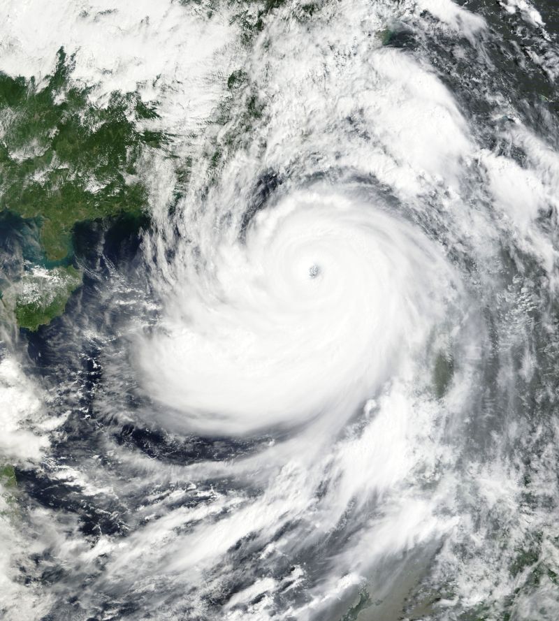
At its closest point, the eye wall came within approximately 40 km of Luzon passing to the north of the main islands of the Philippines but passing to the south of Taiwan.
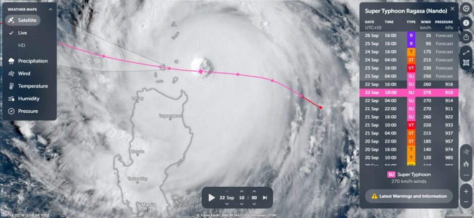
The storm reached a Category 5 system on the Saffir Simpson Scale at peak intensity and sustaining peak winds to at least 260 and 270 km/h as it made its closest approach to the Philippines. It passed over small islands to the north of Luzon.
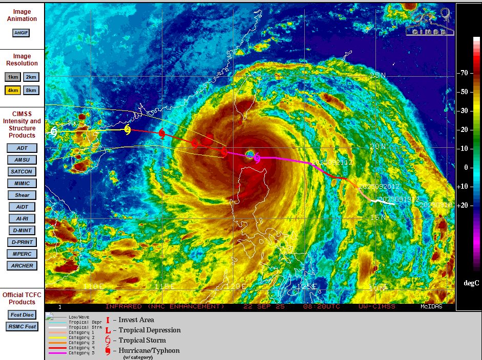
The storm then went into slow decline as it approached Hong Kong coming within approximately 40 km of Hong Kong city (Still as a Category 3 / Category 4 system) with peak winds gusts of at least 190 km/h to 200 km/h.
The storm made landfall over southern China and weakened as it later crossed into northern Vietnam.
While the eye remained out to sea during the strongest phase, the storm has had a significant impact across three countries including at least 27 known fatalities, flooding and wind damage. Some impacts include:
- Major flooding across Hualien County (Taiwan) including a bridge collapse and a lake bursting.
- Major evacuations across cities of southern China and northern Philippines.
- Calayan Island (Cagayan Philippines) being heavily impacted.
- Mudslides and landslides.
The typhoon season across the region can span the whole year but generally, the strongest storms of the year usually form during August and September. The storm which has just occurred is one such system.
The incredible image of the storm from NASA (Image of the Day) as it approached Hong Kong being the feature image shows a defined eye and convection across its entire profile.
This is one storm amongst many such systems to go down into the record books as having a dramatic impact across the region.