Wednesday will certainly go down as a significant weather day. First the heat in which the days temperature had exceeded 30C by 9 am to 9.30 am, followed by an intense thunderstorm that ripped through the region during the early afternoon.
I was fortunate enough to be able to leave work early Wednesday to start my annual leave by 9 am.
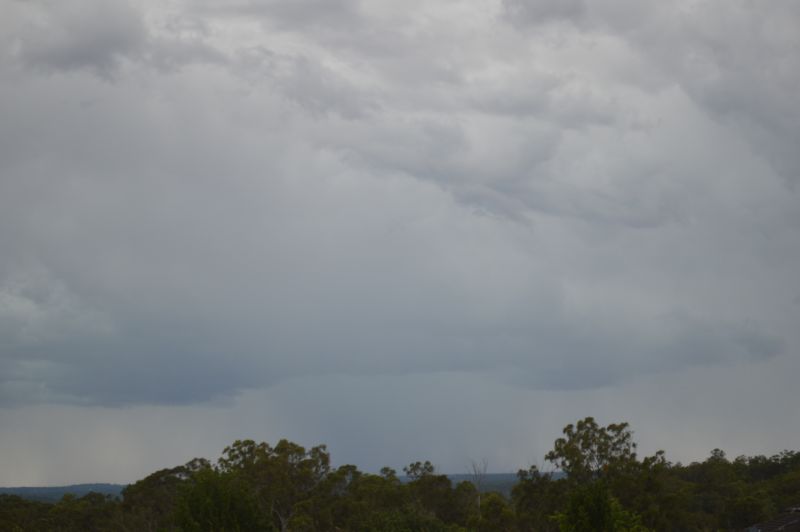
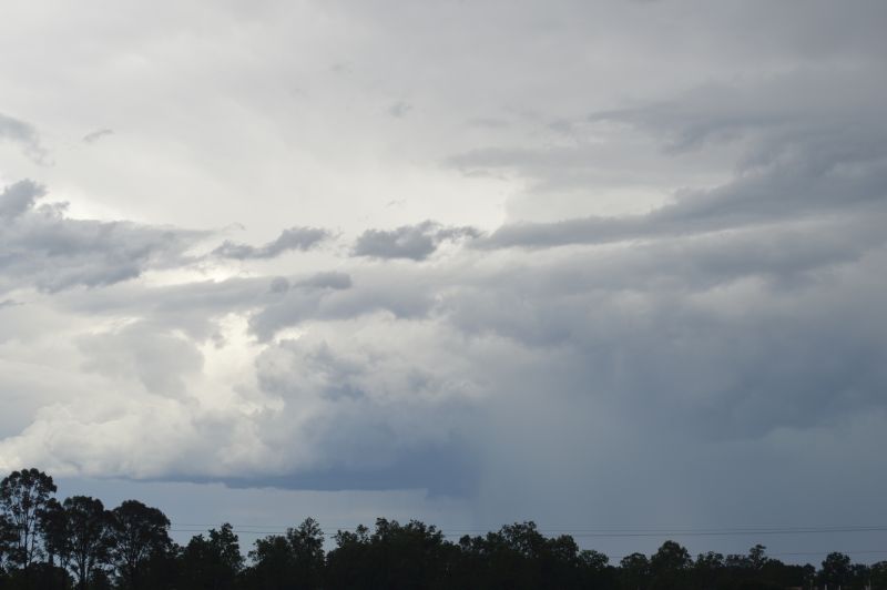
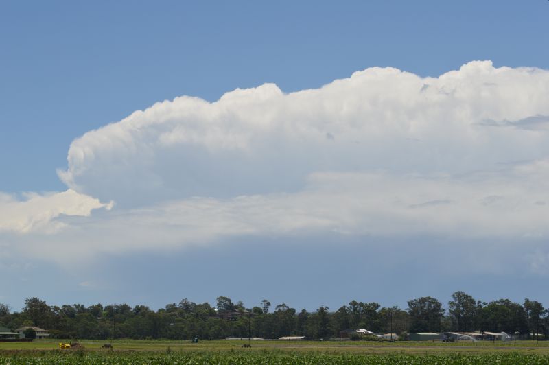
The temperature exceeded 30C by 9 am to 9.30 am then climbed to 34C to 36C depending on location by late morning. Thunderstorms developed during the late morning and early afternoon and I initiated a storm chase to Penrith and Luddenham.
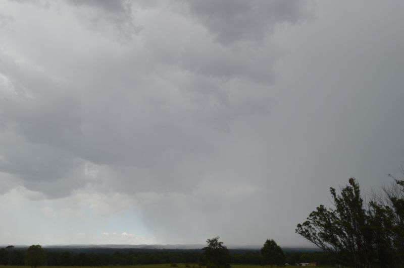
When arriving in Luddenham, I noted that the storm bases were high. I was observing occasional lightning flashes (anvil crawlers and a few distant cloud to ground strikes).
Storms were fast moving (West to east). As the main storm line passed over, I quickly moved north wards and drove into some very strong wind gusts including a short burst of heavy rain at Penrith.
Interestingly further east, I was observing a lowered based with rain beginning to fall from the cloud. Given that I had driven through some significant winds, I note the following:
- Official wind gusts reached 72 km/h to 75 km/h at Penrith and Richmond weather stations.
It appeared that something unusual was occurring towards my area.
I continued the chase as much as possible but the entire weather system overtook me and it was soon moving off the coast. I returned home from Richmond. As I was driving though Blacktown, I noted more and more tree branches lying across the ground including two sets of traffic lights that were blacked out.
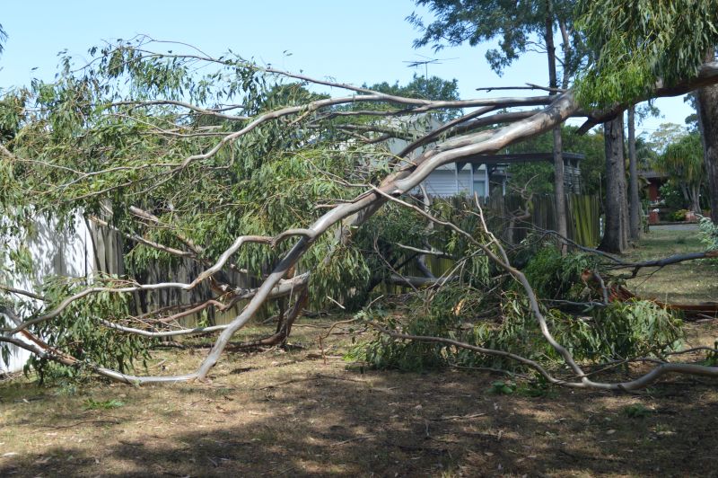
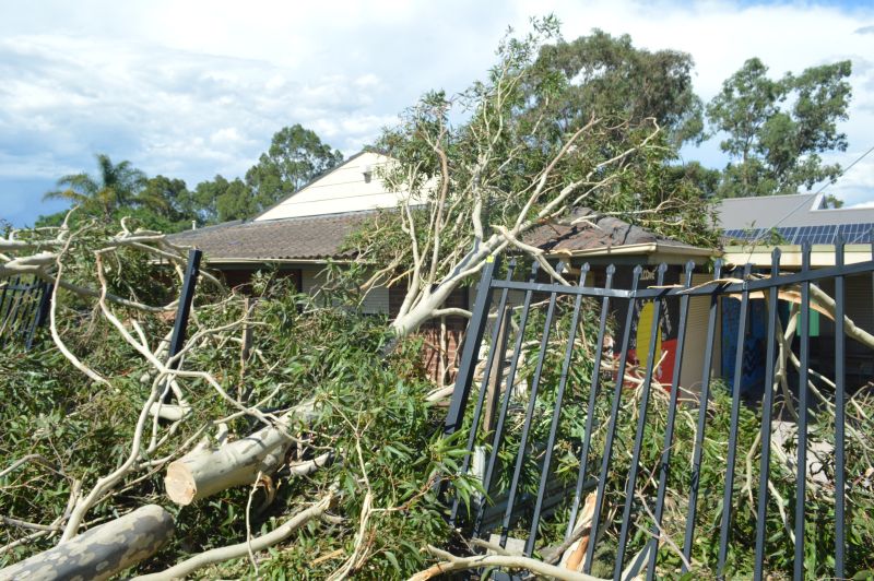
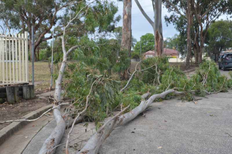
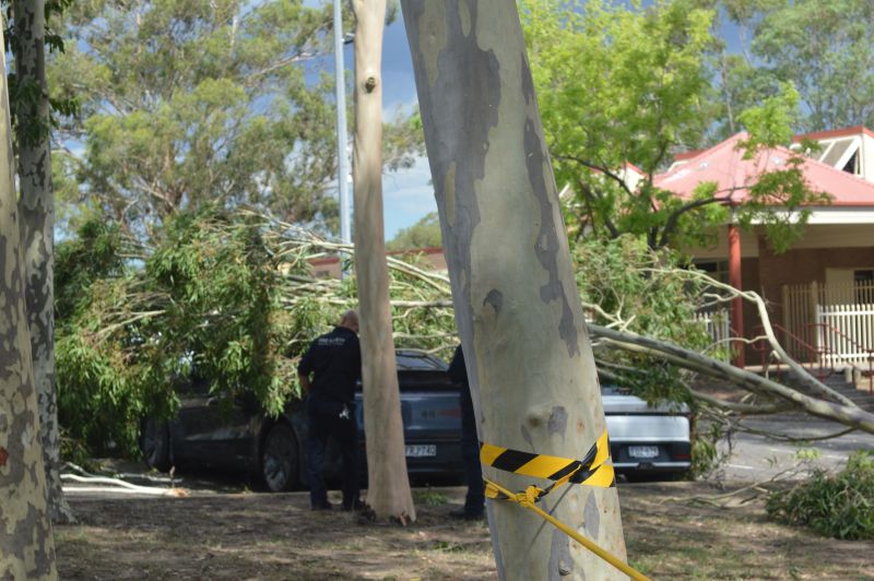
As I passed through Doonside, I was stunned to see entire trees lying on the ground, powerlines down in some areas and even damage to buildings.
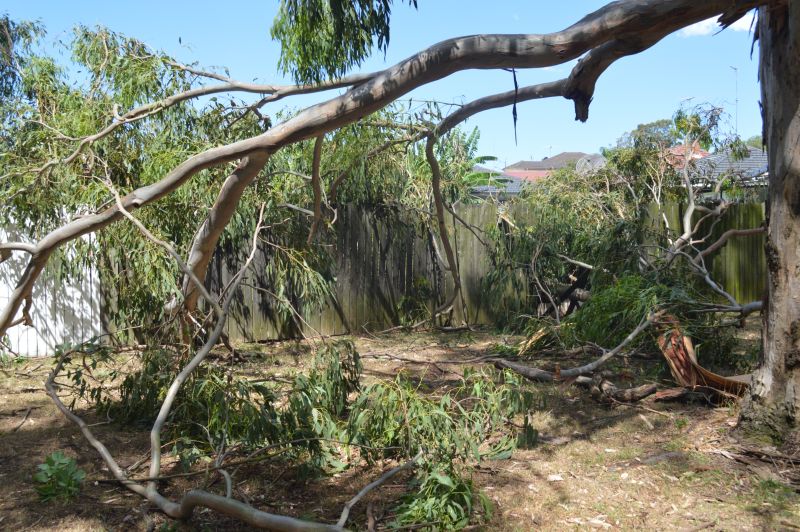
I soon discovered that Doonside where I live has taken a major hit from what appears to be a microburst event. The amount of damage observed and the number of trees down is clearly well beyond the official wind recordings identified at the nearest weather stations. In respect:
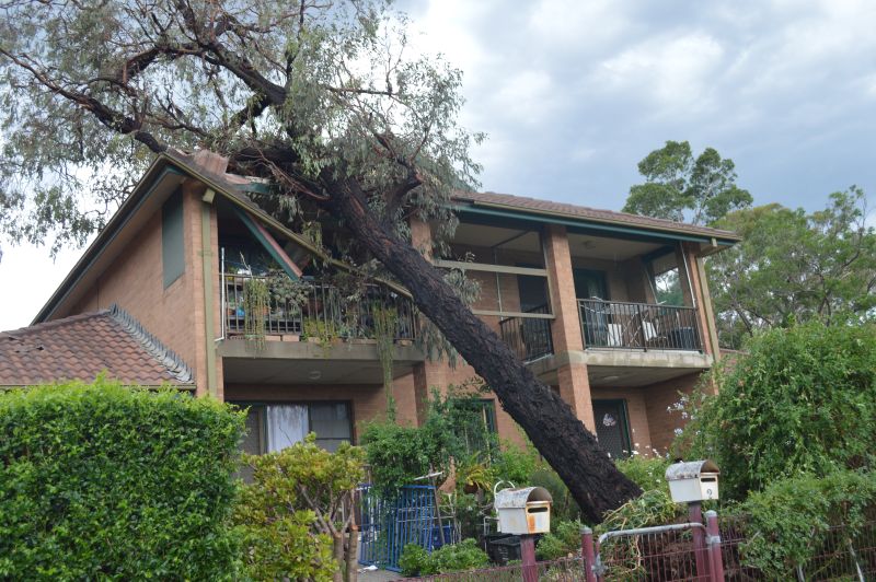
- A tree has fallen onto a two storey townhouse in Rosenthal Street opposite the IGA supermarket.
- I observed two vehicles damaged by a fallen tree.
- Numerous trees down including whole roads blocked by fallen trees.
- Roads cordoned off as emergency services attend to fallen trees and live powerlines.
- Damaged buildings.
- SES crews in the area, the sound of chainsaws and police attending to road closures or redirecting traffic.
My wife advised me of hail to 2 cm in size and very intense rain and wind for a short period of time.
While the storms were high based with some interesting cloud structure at times, a major cleanup operation is now underway across Doonside which will take some time to complete.
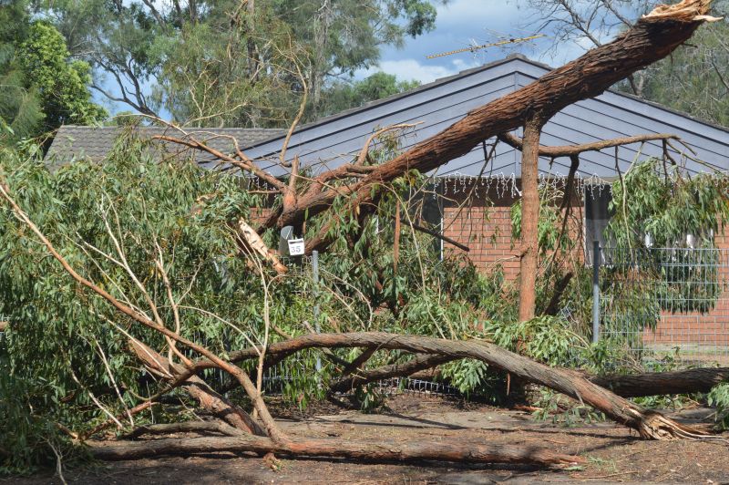
The images of the storms are taken during the days chase and all the attached images of the storm aftermath were taken around Blacktown and Doonside.