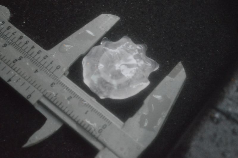
Note: This thunderstorm did produce copious amounts of hail of up to 5 cm in size. During my storm chase, I encountered hail to 3 cm and documented this around St Marys and Kingswood.
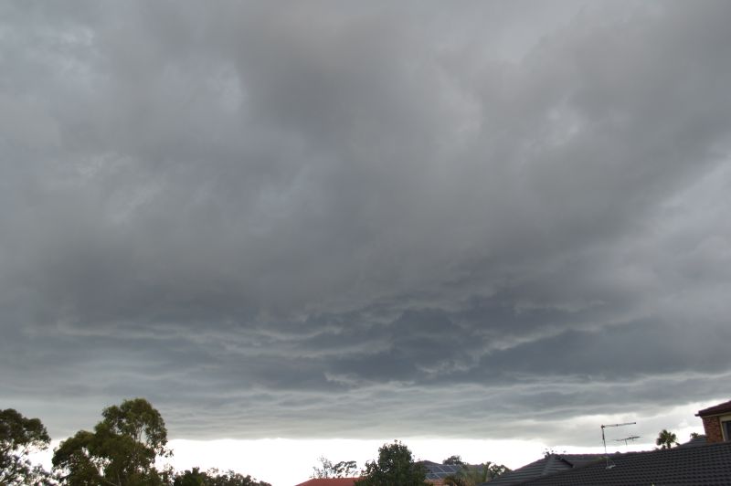
Mid to late afternoon Saturday, I was having a lay down when I heard the sound of distant thunder occurring outside. I went outside and observed a weakening storm to the south and observed a new developing thunderstorm cloud overhead and just to the west. This was of interest.
I grabbed my camera and took a few photos of the rapidly developing storm. Given what I was observing, I quickly packed my camera gear and headed out to intercept the developing thunderstorm cell to the west. As I approached the base of the storm, I observed a few cloud to ground lightning strikes.
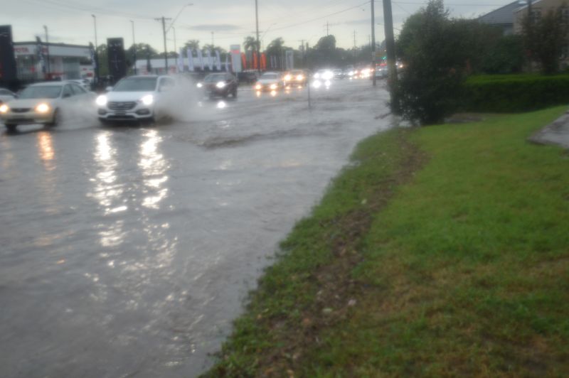
I entered the rain core just to the west of the intersection of the Great Western Highway and the M7 Motorway. I travelled west along the Great Western Highway heading deeper into the core encountering very heavy to torrential rainfall.
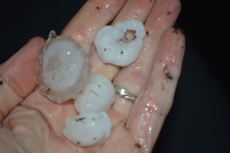
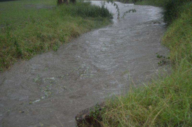
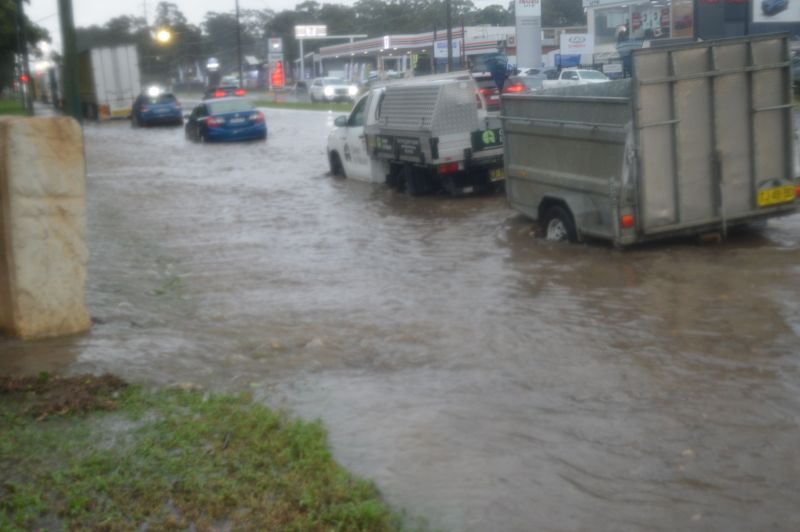
When I reached St Marys, I started to hear the sound of hail hitting the car roof and started to encounter flash flooding along some of the roads. I drove further west to Kingswood where I stopped to sample the hail and take a closer look at what was occurring.
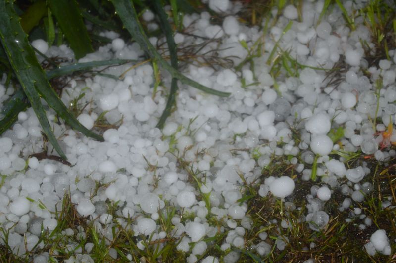
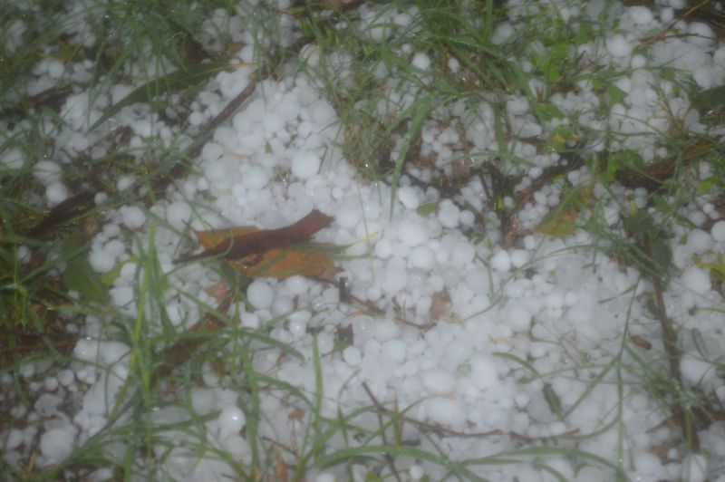
In an area close to Chapman Park, I observed and verified hail to 3cm in size and even some hail drifts at some locations.
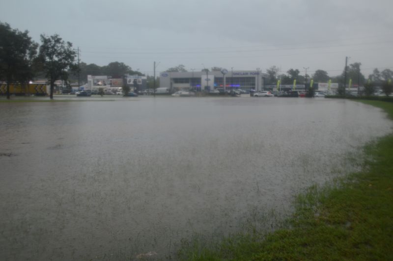
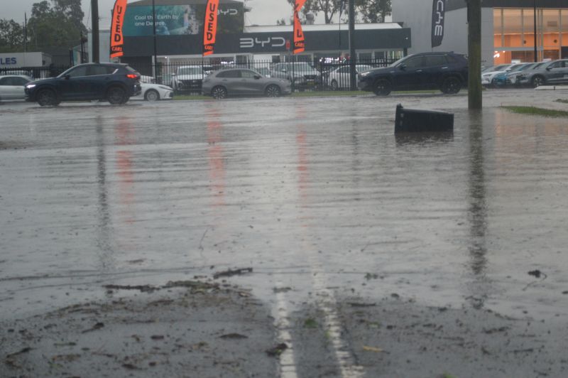
In addition to the hail, I encountered significant flooding of roads, local creeks and even flooding along the Great Western Highway. The Great Western Highway had partially come to a standstill due to the amount of rain and flooding that was occurring.
At Kingswood, I could tell that a power failure had occurred and emergency services were out attending to emergency callouts.
After I had finished taking my photos, I returned home.
The thunderstorm event was quite significant for the Penrith region. The Bureau of Meteorology had issued a severe thunderstorm alert for the storm for large hail and flooding rains, both of which certainly occurred.
While the storm did produce hail to 5 cm in size, that size hail did not occur where I was. However, the 3 cm hail that I observed and documented was still significant enough.
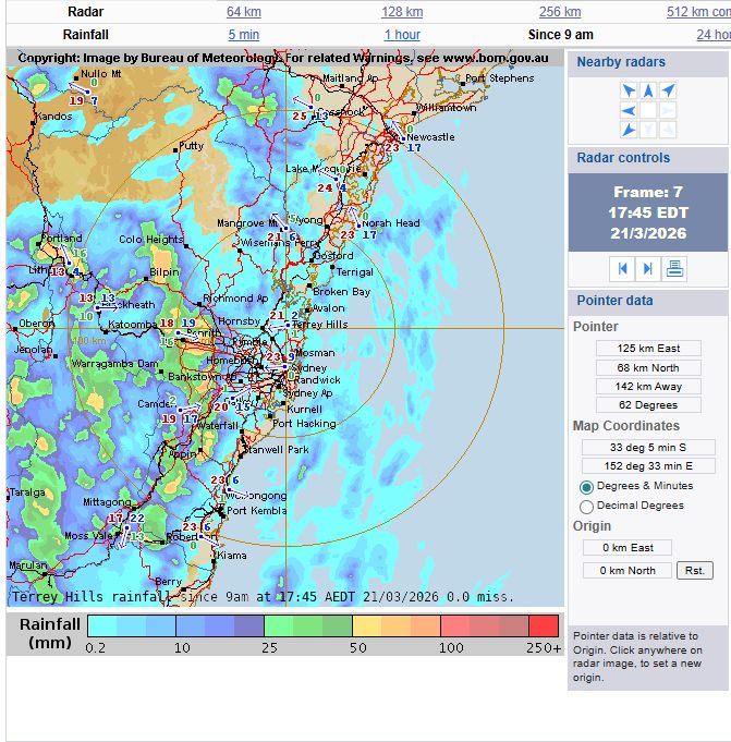
The heaviest rain event occurred at Shanes Park where 35.2 mm fell. However, the storm occurred within that part of Sydney with a lower count of rain gauges.
The "Sydney Radar Rainfall" amounts from the storm when analysed properly demonstrates that a small area just to the east of Penrith received greater than 50 mm of rain and anywhere up to 70 mm. That area takes in Kingswood and St Marys. Given the amount of flooding that I observed, one can safely assume that between 50 and 70 mm of rain fell from this event across that local area which is where I documented the flooding.
It is known that a peak wind gust of 91 km/h occurred at the new Western Sydney International Airport from this event.
All photos attached to the post were taken around St Marys and Kingswood.