I was in Indonesia between Tuesday December 16 and Tuesday 13 January 2025 and 2026 being a 28 day period.
In addition to the family related trip, I also spent time documenting what the Indonesian monsoon was like during December and January. The entire period was spent in a city called Yogyakarta located approximately 425 km south east of Jakarta in southern Java.
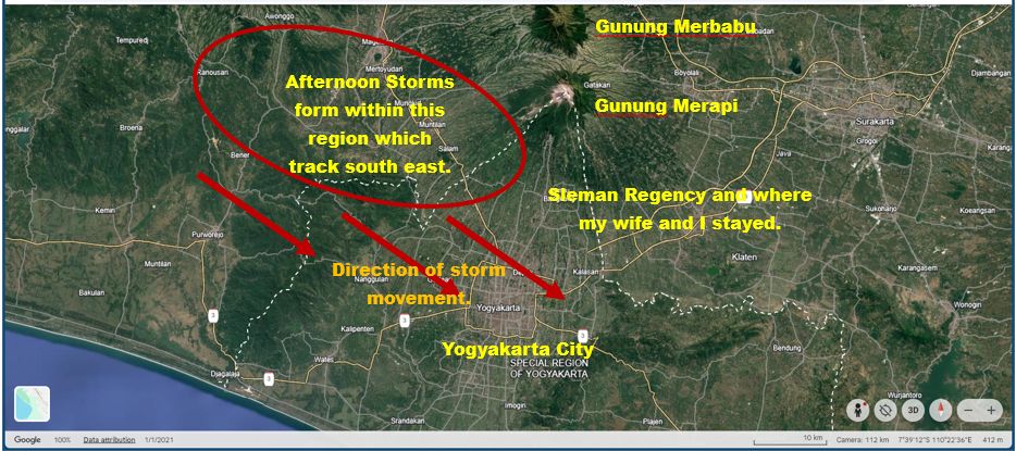
The city lies approximately 29 km inland from the coast and there are two volcanoes to the north being:
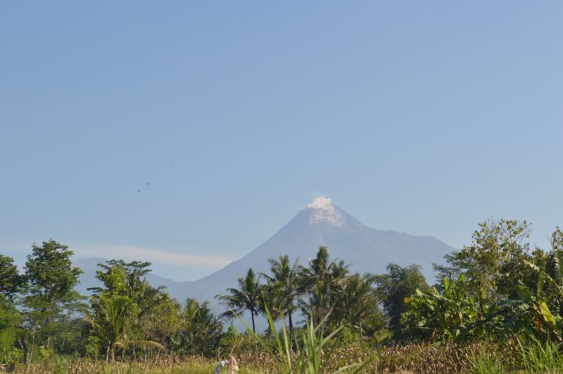
- Gunung Merapi which is active and rises at least 2,951 metres above the city.
- Gunung Merbabu which is dormant but rises at least 3,133 metres high just to the north of Merapi.
There are two other volcanoes to the north west being Gunung Sumbing and Gunung Sundoro both of which are currently dormant.
This is important as it appears that the presence of such mountains enhances the development of thunderstorms across the region. Furthermore, a boundary where winds collide from two different directions also lies across the centre of Java in proximity to where the mountains or volcanoes are located.
The climate of Yogyakarta is “Tropical monsoon” with December and January being the wettest months and June to September being the driest period.
Note: I have been here during August and September 2023 and 2024 and on both occasions, almost no rain fell demonstrating how dry it can get during the peak of the dry season.
It would appear that the wet season is similar to what Darwin (Northern Territory) experiences in which most mornings would be dry. During the afternoon, convective thunderstorms would develop in proximity to where the mountains or volcanoes are located which would then track towards and over Yogyakarta city.
After dark, the storms would go into slow decline and the next day the same conditions would occur again if conditions allow. Generally, the storms are convective in nature.
Temperatures were a constant 29C to 32C during the day only dropping to around 23C during the mornings before sunrise. The humidity levels were often above 80%. Average annual rainfall is 2,157 mm with January being the wettest month with an average of 392 mm falling.
During my stay here, there were several thunderstorm events and at least 2 monsoon outbreaks. Of this, a few notable thunderstorm events stood out which was of interest being:
- The storm events of Saturday 20 December 2025.
- The events of Thursday 1 January 2026 in which five thunderstorms trained over the same area during the afternoon after 1 pm.
- The late afternoon storm events of Monday 12 January 2026 across northern Yogyakarta city.
I was surprised to discover that the stronger thunderstorms that occurred here are capable of causing property damage and during my stay here, there were even storm events that had they occurred here in New South Wales, a “Severe Thunderstorm Alert” would have been warranted given their behaviour.
As follows:
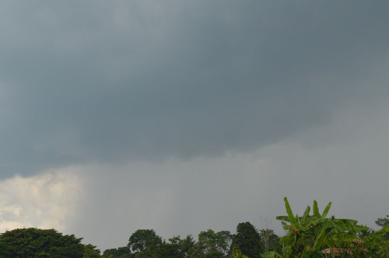
- The storm events of Saturday 20 December 2025
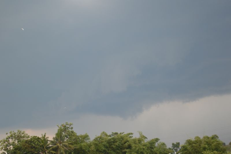
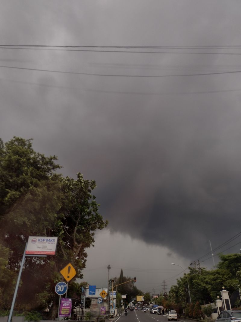
As shown by photos, the first storm of the day had characteristics of what could occur across Sydney. The first storm occurred after several days in which no rain fell. It tracked from the northwest towards the southeast complete with a rain free base. The storm produced intense rainfall and strong winds with local flash flooding.
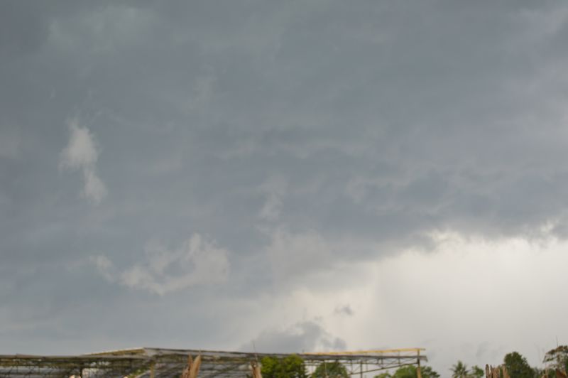
Furthermore, there were also power outages across parts of Yogyakarta and trees were brought down.
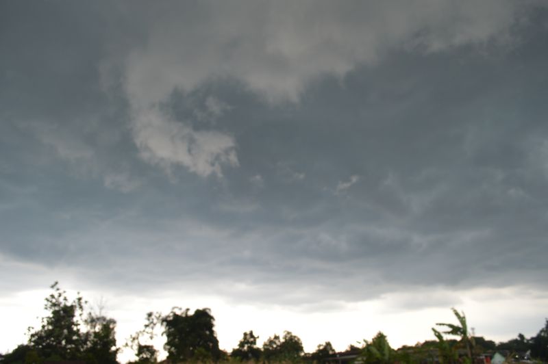
There were two additional thunderstorm events that followed, both of which produced intense to torrential rainfall in short bursts and localised flash flooding.
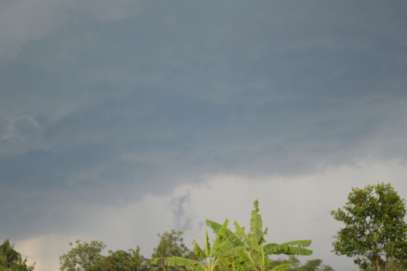
- The storm events of Thursday 1 January 2026
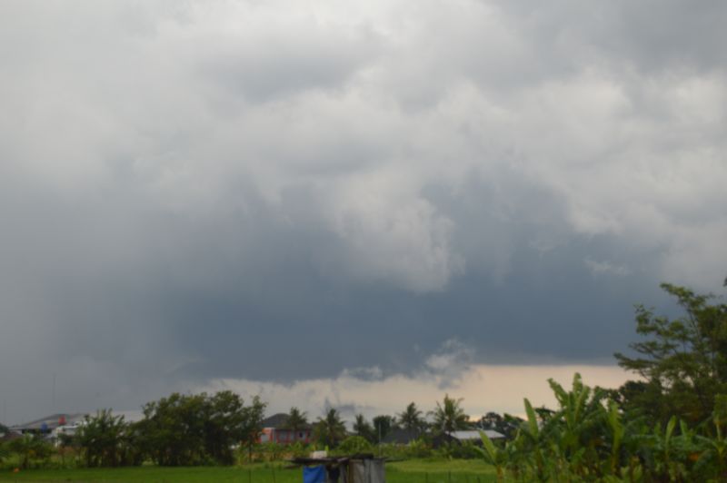
During the afternoon, there were 5 thunderstorms that trained over the same area of Yogyakarta with Sleman Regency being some of the hardest hit areas.
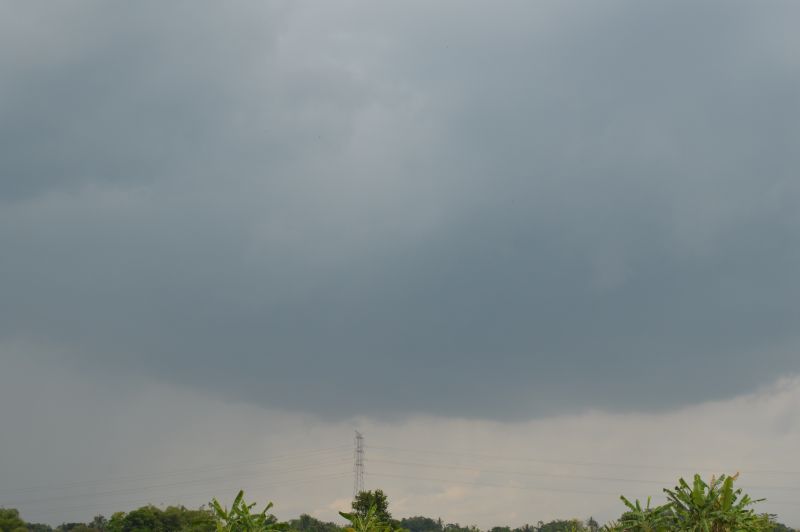
The first thunderstorm formed following a dry period lasting up to 4 days. The storm was certainly interesting as the cell formed southwest of Gunung Merapi. It passed over the area where we were staying. In addition to producing intense rainfall, the air temperature dropped sharply as a strong downburst passed over with intense winds. The raindrops became quite cold and at one point, it was cold enough for hail to fall. While no hail was observed, it was close.
Note: Hail has occurred in Yogyakarta with the last such event during the afternoon of March 11 2025 where hail over 2 cm in size was recorded in some areas such as Sleman, Bantal Regencies and Yogyakarta City. It would appear that thunderstorms need to exceed 15,000 metres in height across the region for hail to fall and physically reach the ground based upon research undertaken.
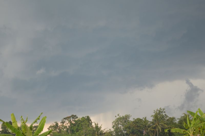
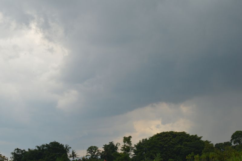
I never expected to see this in Yogyakarta so close to the equator. As the storm tracked southeast, there was a period where continuous thunder was audible with lightning concentrated within the anvil shield that was overhead. The storm certainly reached severe intensity during its peak phase.
A second thunderstorm occurred shortly after and that in itself produced a torrential downpour that overwhelmed the local drainage system.
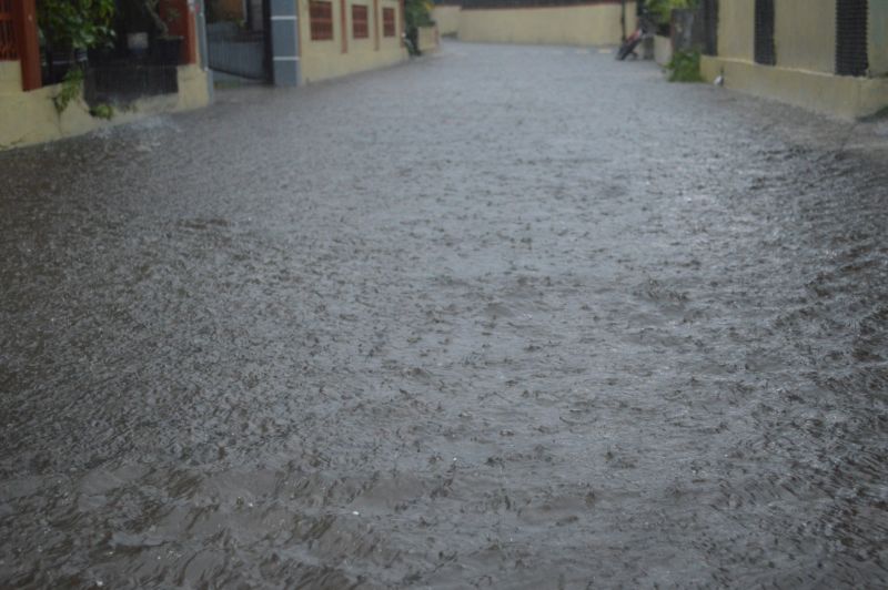
Looking west, it was clear that a boundary was present across the region because a new thunderstorm formed (Storm number 3). The storm was different as it produced isolated cloud to ground lightning strikes rather than lightning concentrated within the top part of the cloud. Again, a torrential downpour ensured that caused localised flash flooding overwhelming local drainage systems.
This was followed by a fourth thunderstorm with intense rainfall.
The final thunderstorm occurred after sunset which concluded the storm events of the day.
The storm events resulted in power loses across the region.
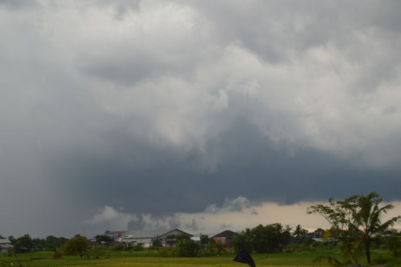
- The storm events of Monday 12 January 2026
Following a humid morning, a thunderstorm developed on the southern side of Merapi that tracked southeast over northern Yogyakarta. The storm produced an interesting base and very intense rainfall when underneath it.
Finishing remarks
There were several other thunderstorm events during my stay here but the above three events stood out amongst all other events.
I have taken various photos to show case each event. I also attach an image of Gunung Merapi given that this volcano certainly influences the development of thunderstorms across the region.
Finally, a basic map is provided showing the general direction of thunderstorm movement across the region.
Note: The image of Merapi (Image 1) shows a minor eruption occurring which in itself is incredible to see. This will be covered in a separate statement.