The final burst of summer for 2023/2024 will conclude during Monday and Tuesday due to the passage of a significant weather change.
As shown in the Himawari satellite photo of Southern Australia (Feature Image above), the change is currently crossing through Western Victoria which is producing a band of moderate to heavy rain showers and even some thunderstorm activity. The change is significant as it will herald the following:
- The final day when 30C temperatures are likely to be reached for the spring / summer / early autumn period for 2023/2024 across southern and southeastern Australia.
- A shift to more autumn like temperatures for April and a significant temperature drop.
Initially it was expected that the change would produce a significant rain event for Victoria and inland Southern New South Wales however, this appears to be downgraded to some extent.
The change will cross through New South Wales proper overnight Monday and throughout Tuesday reaching Sydney during the afternoon. The change will not provide significant rainfall, at least for the initial period for coastal New South Wales. However, it is what models are showing for Thursday to Saturday this week which is of interest.

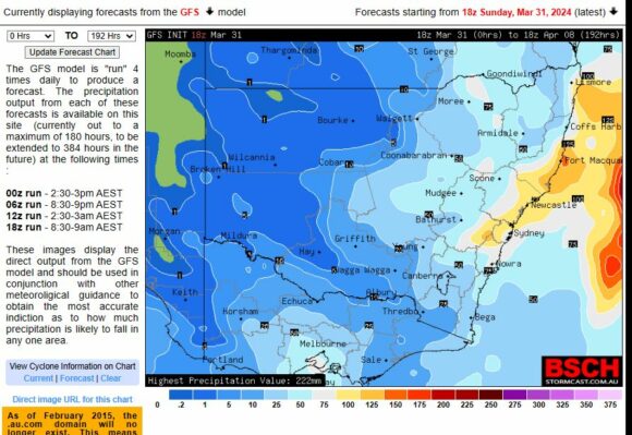
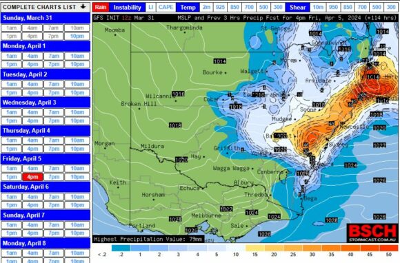
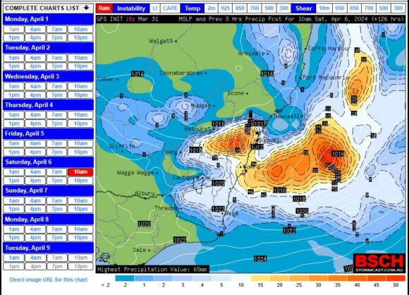
Currently, actual rainfall forecasts do not appear to be lining up with weather models but there are clues provided. Weather models hint at a significant coastal rain event for this period especially during Friday and into Saturday for the whole of the New South Wales coastline.


It appears potential exists for cumulative totals to exceed 100 mm and it is possible that an east coast low will form off the New South Wales North Coast which would track southwards delivering widespread moderate to heavy coastal rainfall.
Forecasts are being made for cumulative totals for Sydney to be greater than 65 mm but when looking closely at some weather models, 50 to 100 mm and 100 to 120 mm are being suggested.
Attached are model samples from the BSCH (Various) showing what the rainfall potential looks like at the present time. This is becoming one event that is worth watching as the week progresses.
Given that ocean temperatures off the coast of New South Wales are above average and given that a dry and warm March has concluded, this is one weather system that would be capable of having a significant impact along the coast of New South Wales.
