
An interesting weather setup appears to be unfolding across southern Australia that is expected to result in a multiple day event where maximum temperatures of over 40C could be expected.
The heatwave that is anticipated is expected to cross through South Australia during Saturday arriving across the inland southern Australia by Sunday. What is most interesting about this event is that the heat appears to stagnate for at least 4 to 6 days across the same region before starting to break apart by Thursday 29 January 2026.
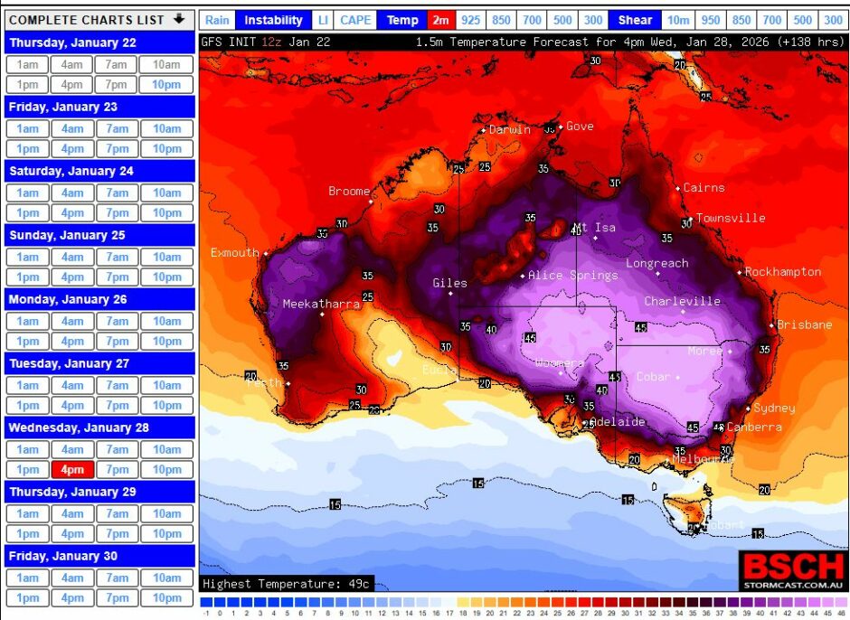
The hot weather is expected to be widespread with the Murray Darling Basin region of New South Wales and Victoria most at risk from the event.
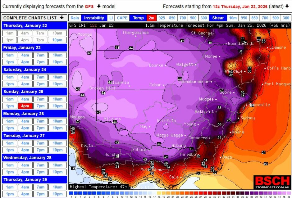
What is most unusual about this event is that forecasts of 44C to 46C and even 47C is being made for towns such as Bourke, Condobolin, Griffith, Mildura, Tibooburra. These are extreme maximum temperatures usually confined to inland desert regions. Instead, it is suggested that such conditions will encroach into areas that rarely if ever see such conditions for January or anytime during a typical summer.
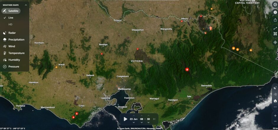
In terms of the fire situation, there are still fires burning across Victoria such as the Walwa blaze in northeast Victoria which are not extinguished. The extended heat has potential to ignite new fire fronts in coming days.
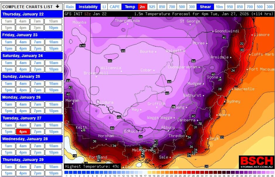
Interestingly, the coastal areas of New South Wales will not see any of this heat except for 1 day being Sunday where maximum temperatures may reach at least 38C at some locations furthest away from the coastal fringe. As such, most of the event will be confined to areas west of the Great Dividing Range.
I have attached some GFS forecast maximum temperatures models for the new week. It is unusual to see this across such a wide area for such a long period of time. This is certainly an event that will be followed in due course.