An interesting but costly thunderstorm event struck the Houston metropolitan area and surrounds of Southern Texas (USA) during the afternoon of Thursday May 16 and into Friday May 17 2024.
It appears following analysis of this, the National Weather Service has declared this event to be a “derecho”.
Derechos are well documented across the Mid West USA and should they impact a major city, then the damage can be considerable including but not limited to:
- Tree losses.
- Buildings (Roofs being ripped off buildings).
- Infrastructure damage such as power lines being brought down.
- Motor vehicle damage.
The term “Derecho” is defined by NOAA as a widespread, long lived band of storms that moves rapidly that forms a bow echo. They can be associated with a squall line or a quasi linear convective system.
Wind damage from these occur in one direction being straight line winds. The winds must extend for at least 400 miles (650 km) and must be 60 miles (100 km) wide. Wind gusts must exceed greater than 93 km/h at most points along most of its length with peak wind gusts of greater than 121 km/h during the event.
In addition to a bow echo, the storm system should also feature rear inflow jets.
The winds from these are produced by downbursts / embedded microbursts from the thunderstorm clouds.
The storm system must travel at speeds of at least 50 miles per hour (80.4 km/h) although strong derechos have been clocked moving at 70 miles per hour (113 km/h).
As such, these are often intense thunderstorm systems having significant impact to any town or city in their path.
The event that struck Houston and surrounding areas of Texas is interesting as it appears to have reached the threshold needed to be declared a derecho.
What makes this event different is that such a system is rare for this part of Texas. In particular:
1 - The storm system went right over the city of 2,306,000 residents (6.8 million across the wider metropolitan area) with windows being blown off skyscrapers.
2 - It is believed that peak wind gusts topped 100 miles per hour (160 km/h) as the system passed over Houston although the highest verified wind gust recorded by an anemometer topped 78 mph (126 km/h).
3 - It is also confirmed that there were 7 fatalities and over 1 million homes lost power across the city.
4 - There were two tornadoes rated EF1 confirmed in Cypress and Waller County.
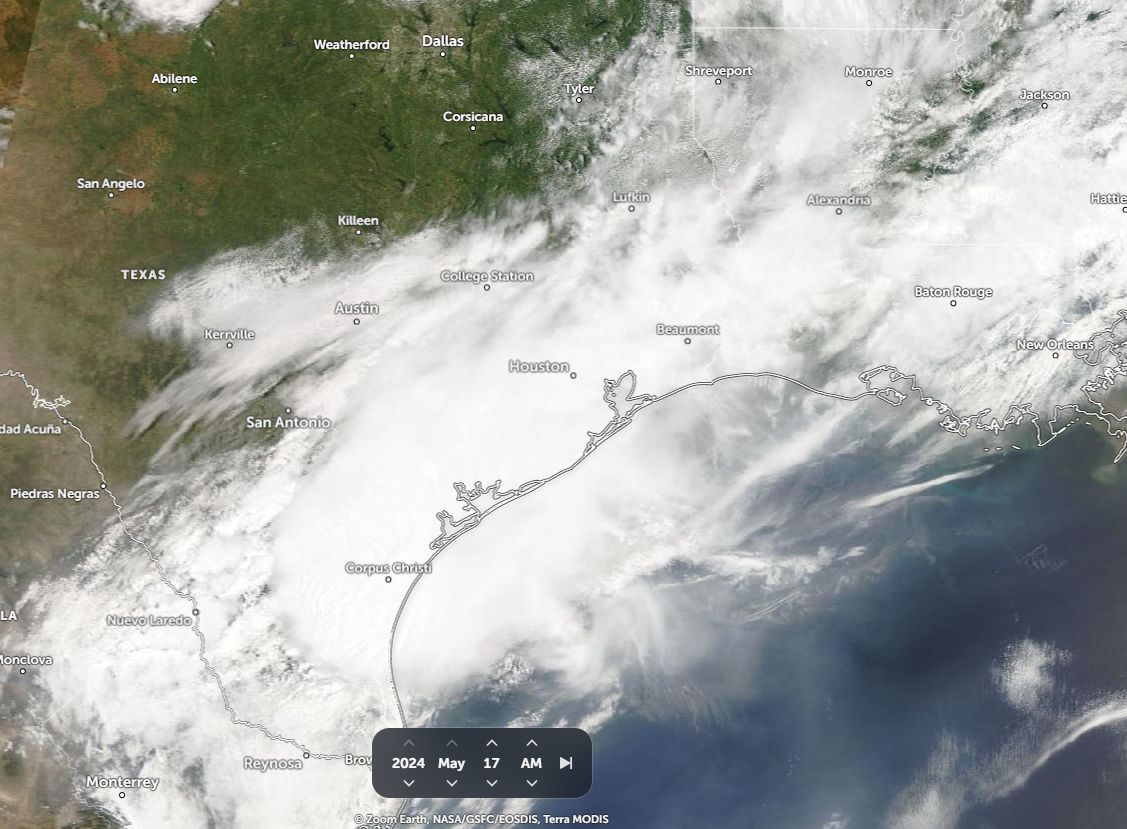
As shown in the satellite images of Houston (NASA) before and after (Below), the VIIRS sensor on the NOAA / SUOMI NPP satellite clearly shows the extent of power loss across the city following the event.


The final damage bill is not currently known but will be considerable given the size of Houston and affected area.
The satellite photo of the affected area above is the best that can be obtained showing the storm system over the Houston region (NASA Worldview May 17 (AM) 2024).