A weak early morning southerly wind change moving north along the coast was enough to generate early morning showers on Wednesday morning across parts of Sydney that resulted in localised flooding.
As usual during such events, the heaviest rainfall totals occurred along the coastal fringe where the Spit Bridge at Mossman received 130 mm from the morning event.
The heavy showers were hit and miss. Heavy rainfall would fall within one area while suburbs in nearby areas received little or no rainfall.
What made this event a little more unusual is that at around 5 am Wednesday morning, a separate rain cell formed over Horsley Park (Western Sydney) and slowly tracked north. This affected most suburbs within an area from Blacktown to the east to Penrith to the west. As such, a separate region of Sydney was impacted by heavy rainfall for a period.
While coastal rainfall ranged from 50 to 130 mm, rainfall across inland suburbs where the event occurred ranged from 25 mm to 72 mm.
The rain cells were slow moving and dumped considerable rainfall over short periods of time.
I observed this at Doonside where close to 25 to 30 mm fell in the space of 30 minutes between 5.30 am and 6 am.
By sunrise, much of the rainfall had eased with the rain cells in decay.
The heaviest totals from the event includes:
Eastern Sydney
- Mosman (Spit Bridge) - 130 mm.
- Randwick - 90.4 mm.
- Allambie - 87.5 mm.
- Rose Bay - 84.6 mm.
- Belrose - 62 mm.
Western Sydney
- Shanes Park - 71.6 mm.
- Penrith Lakes - 52.2.
- Fairfield City Farm - 25 mm.
- My home rain gauge - 30 mm (As Doonside was in the path of this).
Interestingly, I have noted that this is the third major downpour so far this month in which an intense downpour has impacted Doonside where more than 20 mm of rainfall has fallen within a short period of time.
While it is suggested that thunderstorms may have occurred from some of these, I did not observe any lightning or hear any thunder Wednesday morning and thus I cannot verify if this was an actual thunderstorm that impacted the region.
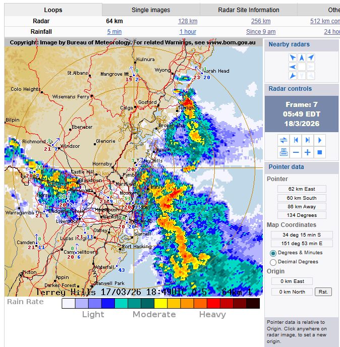
Following this event, further heavy showers impacted parts of Sydney during Thursday. This time, they formed approximately 10 km inland from the coast then spread west only to weaken west of Blacktown. The heaviest rainfall fell at:
- Bankstown Airport - 54 mm.
- Auburn and North Ryde - 27 mm.
My home rain gauge - 19.8 mm (Again heavy showers impacted the Blacktown region for a second day in a row).
Again, rain cells were slow moving and thus while cumulonimbus clouds were observed, they collapsed in on themselves due to lack of upper level steering winds. Heavy rainfall was often localised to small areas, especially around the Auburn / Merrylands area.
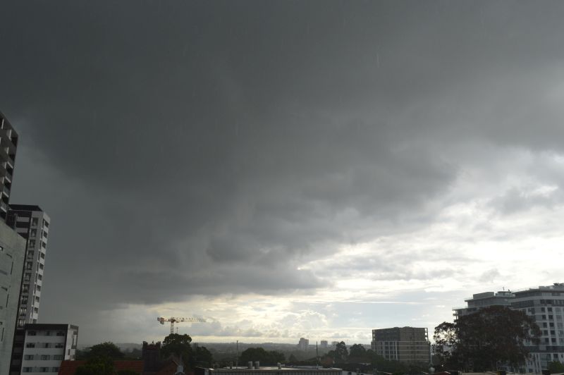
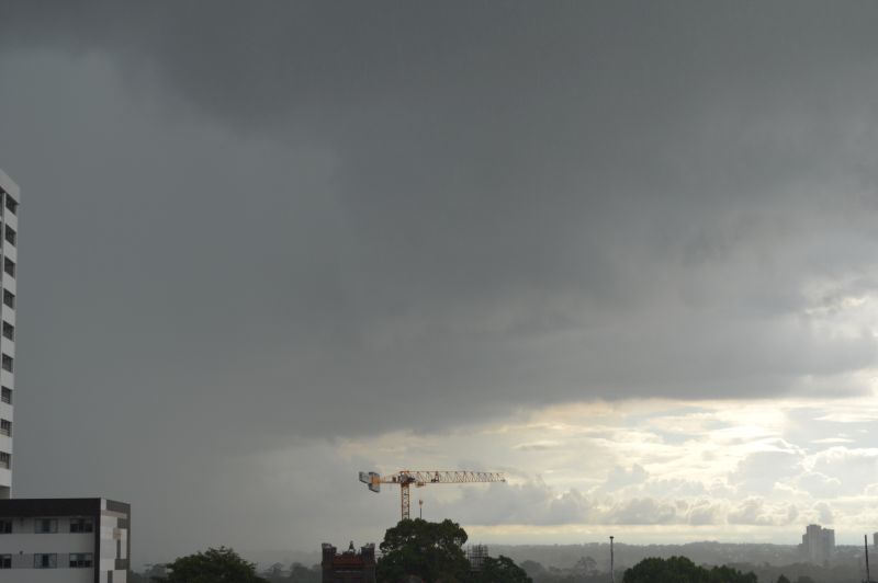
I managed to take a couple of photos of one such cloud formation over Auburn late Thursday afternoon to show a typical rain event that occurred during the day.
,