Extreme Storms

Rain

Heavy rain and flooding NE NSW and SE Qld 11 to 14 December 2020

· by Harley Pearman

A significant rain event rain across the coastal regions of north east New South Wales and South east Queensland has been unfolding and the event is likely to continue for the next few days.

The event has been coastal in nature with the rain reaching the eastern side of the Great Dividing Range but not penetrating westwards into the inland areas. As at Sunday morning 13/12/2020, very little rain has penetrated inland and during the same time, very little rain has moved southwards of the Mid North Coast.
In Particular and for the 24 hours to 9 am 12/12/2020, the heaviest rainfall occurred around Coffs Harbour and the nearby Bellinger Valley. It is likely that the surrounding hills intensified the rainfall due to orographic processes with the heaviest rainfall being concentrated to localities within the valley but east of Point Lookout.
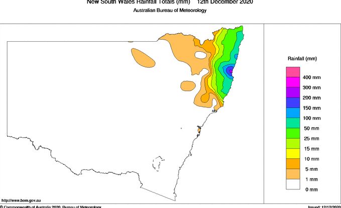
The heaviest rain includes 203 mm at Bowraville and 161 mm at Bellinger. Coffs Harbours was drenched with rainfall reaching 150 mm up to 156 mm.

Another location on the mid north coast being Logans Crossing received 187 mm.

For the 24 hours to 9 am 13/12/2020, some exceptional rainfall totals have occurred within the Tweed River Valley areas and south east Queensland including the Gold Coast city area.

For New South Wales, the heaviest rainfall includes – Tweeds Heads – 253 mm, Bray Park – 250 mm, Uki – 211 mm and Repentance – 182 mm. Most localities within the Tweed River Valley has been drenched with flooding likely.
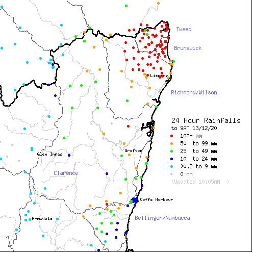
In south East Queensland, some exceptional rainfall totals for the same period includes Upper Springbrook Alert – 475 mm, Tomewin Alert – 370 mm and Tallebudgera – 346 mm. Such totals and others are confined to areas just south of Brisbane encompassing all the Gold Coast City areas and its hinterland.
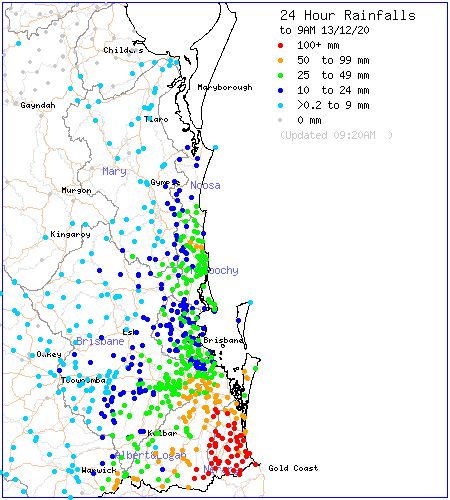
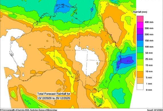
The forecast models continues to suggest further heavy rain which has potential to cause further flooding. Some of this rainfall is expected to drift further south towards Sydney later in the week although such high totals are not expected. While some models suggest that some moderate rainfall will make its way into the eastern inland New South Wales, other models are suggesting that only light falls are likely to occur with the heaviest falls being concentrated to coastal areas north of Sydney.
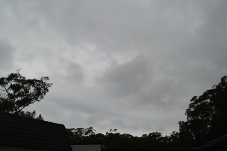
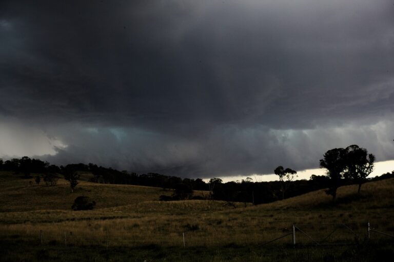
Open the storm map around NE NSW & SE QLD rain (Coffs Harbour)

More storms near NE NSW & SE QLD rain (Coffs Harbour)

Ex Tropical Cyclone Alfred – The aftermath continues includes images Bellinger Valley NSW – Sunday 9 March 2025 9 Mar 2025 · Bellinger Valley, NSW Moderate to heavy rain and East Coast Low New South Wales – 25 to 28 September 2024 28 Sep 2024 · Coffs Harbour, NSW One of the big time events. After a period where storm chasing was not going to plan nailed this one perfectly. 30 minutes of hailWest of Ebor mid … 10 Jan 2023 · Ebor, NSW One of the big time events. After a period where storm chasing was not going to plan nailed this one perfectly. 30 minutes of hail West of Ebor mid … 10 Jan 2023 · Ebor, NSW Storms from South of Grafton through to Yamba with hook echo for a fair bit of a time! Not for Media Use Licensing available Call 0408020468 www… 1 Jan 2023 · Grafton to Yamba, NSW Some may recall this supercell has it been 4 years!! Storms from South of Grafton through to Yamba with hook echo for a fair bit of a time! Not fo… 1 Jan 2022 · Grafton to Yamba, NSW On this day 21 years ago, I was to memorise 2 sets of 19 maps of AVN (GFS) and targetted Coffs Harbour. A storm developed on the Dorrigo Plateau mount… 5 Nov 2021 · Coffs Harbour, NSW Today is the anniversary of Tyndale when I used to go out and get giant hail 26th October 2003. Dave Croan was with me doing his measurements – this … 26 Oct 2021 · Tyndale, NSW Severe storms and hail events – October 2021 – Eastern NSW and QLD 23 Oct 2021 · Eastern NSW & QLD hail (Coffs Harbour) Not bad for a mid north coast Earlier structure before the green tinge and further updraft history. Time-lapse of this stage should be great! Then la… 10 Apr 2021 · Kempsey (Mid North Coast), NSW Rain events and flooding – Eastern New South Wales and Queensland – 21 – 28 February 2021 27 Feb 2021 · NSW North Coast (Coffs Harbour) Extreme Storms Whiporie Supercell 5th January 2021 9 Jan 2021 · Whiporie, NSW

All storm reports from NE NSW & SE QLD rain (Coffs Harbour) →

Also on 13 December

After the storm Hail damage repair Hail dents removed from behind, factory paint kept. Hail Dent Repair. Chase with us Chase a storm for real Guided storm chasing tours in Australia and Tornado Alley. See Thunderbolt Tours.
Coming soon Radar and storm forecasting Live radar tools and severe storm forecasts from the Extreme Storms team.