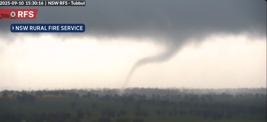
The feature image attached to the report shows a rare but relatively weak tornado impacting a rural area near Tubbal (Northwest of Young) in the states Central West. This was captured by the Rural Fire Service camera mounted on a fire watch tower (Image is around 3.30 pm Wednesday afternoon - Source Rural Fire Service NSW).
This is quite dramatic and highlights a weather system that recently passed through the state.
There were two weather events that crossed through southern Australia during the period. The first one of Sunday / Monday was relatively benign but did produce some useful rainfall across Western Victoria in areas that needed it the most.
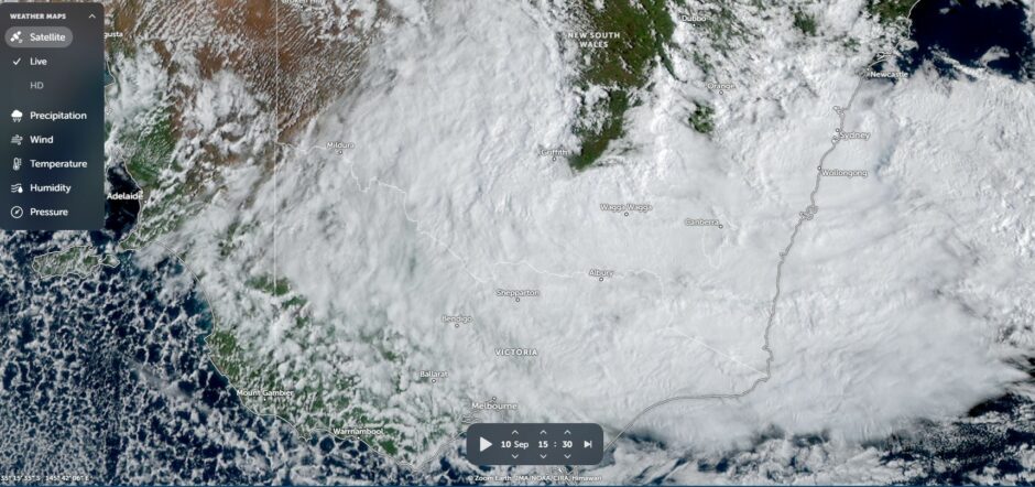
The second event had less impact upon Victoria than expected but had dramatic impact across New South Wales. Some features of the second event include:
- At least two known tornadoes that touched down from separate thunderstorms during Wednesday afternoon across the Central west of the state.
- The first thunderstorm outbreak of the season including some thunderstorm activity across Sydney early Tuesday morning (Around 4 am) and again Wednesday afternoon or late evening.
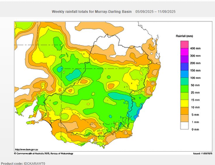
- Some significant rainfall occurring with some coastal locations between Sydney to the north and Ulludulla to the south receiving over 100 mm of rain to 9 am Thursday morning.
September is usually one of the driest months of the year for Sydney (Observatory Hill) but the 122 mm of rain that fell to 9 am Thursday morning was almost double the monthly average of 67.6 mm. Heavy rain and even some embedded thunder was an event that was more unusual for the time of the year but not unheard of.
Lighter rainfall total fell further inland away from the coast.
Interestingly, the heaviest rainfall totals fell on the coastal strip between Sydney and Ulludulla. The two models reviewed Sunday did not depict this outcome. There were some unusually heavy rainfall totals during Wednesday and Thursday with enough to cause some local flooding. The heaviest totals include:
- Mount Pleasant - 178.5 mm.
- Broughton Creek - 178 mm.
- Cronulla South - 147 mm.
- Little Bay - 135 mm.
- Mona Vale - 122 mm.
Inland, Kapooka southwest of Wagga Wagga (Southwest slopes of New South Wales) received 61 mm but such high totals were limited to that location.
Prior to the weather system crossing through New South Wales, the same system brought some interesting and varied weather to other locations including:
- Alice Springs - Received 21.4mm - Some storm damage from wind gusts occurred.
- Tibooburra - In the far northwest corner of NSW received 31.4 mm and 18.4 mm during Tuesday and Wednesday (Total 49.8 mm).
- Birdsville - A wind gust from a storm reached 117 km/h.
It is suggested that there were 467,000 lightning flashes and strikes within 800 km of Birdsville in the 36 hours to midday Tuesday.
This shows how active the system became.
The system moved through fairly quickly and across Sydney, conditions cleared rapidly Thursday morning.