The month of April turned out to be fairly dry with few if any remarkable weather events occurring across southern Australia. However, it appears that this is about to change.
A more significant rain event is earmarked for much of southern Australia over coming days.
The month of April has been relatively dry following a wetter than normal February and March across large areas.
A strong high pressure ridge has dominated for much of April resulting in mostly dry and sunny conditions with few rain events.
This is about to change. A low pressure system and associated cold front is about to pass over southern Australia. This is expected to result in a rain band that should cross through during Sunday and Monday. Useful rainfall is expected with widespread falls of 20 to 30 mm suggested for large areas.
This will be helpful given how dry it has been for the past 5 weeks. Given the suggestions that a strong El Nino could unfold during the latter part of the year, this event could be crucial for the sowing of winter crops.
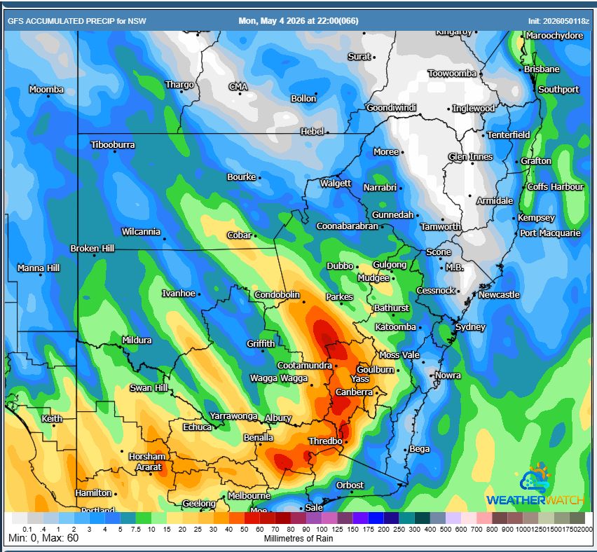
The GFS rainfall plot provided suggests the following:
- The best falls across New South Wales should occur along the slopes and tablelands of the state New South Wales which is typical of such events.
- Very little rainfall would reach the coast.
- The inland cropping areas of Victoria is in line to receive the better totals of upwards of 30 mm.
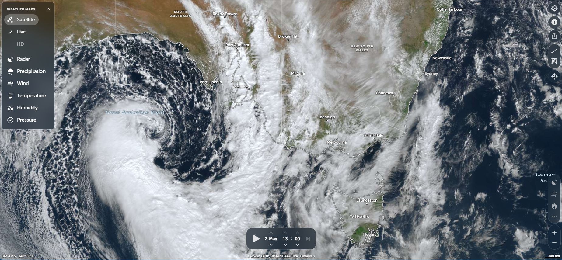
The feature image above shows the approach of the system. The NASA Zoom Earth image of 1 pm Saturday afternoon shows a well defined frontage system and cut off low. It is quite a spectacular system when zoomed in. A narrow rain band is passing through South Australia while the coldest air lies south of the Great Australian Bight.
The same system will cross Victoria and New South Wales during Sunday and Monday which will conclude a 5 week period dominated by dry sunny conditions.