The thunderstorm events of Thursday afternoon was part of a strong cold front and wind change passing across southern Australia effectively heralding the change into autumn and ending the summer season for 2025/2026.
During the afternoon as highlighted below, there were at least three separate thunderstorm events that impacted the Sydney region during the afternoon.
I took an ADO from work which allowed me to document the change in detail. Just prior to leaving home at 12.30 pm early Thursday afternoon, I reviewed the weather models and satellite pictures to ensure that the target area being the Camden / Picton region and southwest Sydney was maintained.
As soon as early convection was sighted to the west, I left home and headed west to Penrith then south to Luddenham. At Luddenham, I stopped for over 90 minutes to monitor cloud formations.
I noted a large amount of alto cumulus castellatus clouds across the sky which is a sign of instability as well as a weak thunderstorm cell to the west.
I was also observing a distant thunderstorm cell on the southern horizon. As such, I was becoming more confident with my forecast.
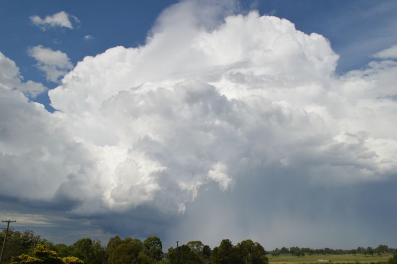
At close to 2 pm, an interesting storm base was observed to the west and I worked out that I needed to be south of Camden to see what would occur with this. This was a crucial decision to make. I headed south to Camden then went 7 km further south. That thunderstorm base identified earlier was growing in size and a single and mature thunderstorm rapidly intensified to the immediate west.
At an open location, I stopped the car and got out with my camera and was shocked to see at least 3 cloud to ground lightning strikes in quick succession. I was not ready for this. Shortly after, I took several photos and some video film. In temperatures of around 30C, this isolated thunderstorm was certainly of interest.
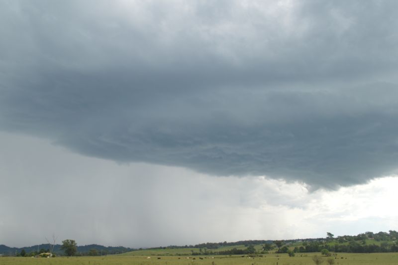
As it approached, I went some 2 to 3 km further south and lined up the base and parked the car off the road to take the hit. This was an isolated, small and compact thunderstorm that certainly packed some severe weather.
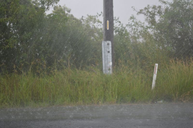
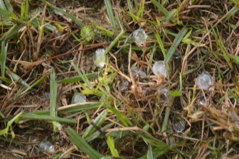
I soon identified that the Bureau of Meteorology had issued a severe thunderstorm alert for this cell. The core passed right over me with intense rain, hail to about 1.5 cm in size and intense wind gusts (Probably gale force in strength). The cell became black on the Bureau of Meteorology Radar as it passed over indicating a hail core.
The storm peaked in intensity as it passed overhead and further to the east. Given where I was on Cowdor Road, there was only one opportunity to get this due to its location.
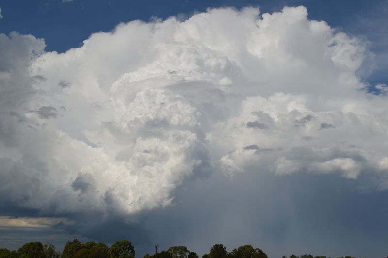
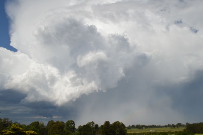
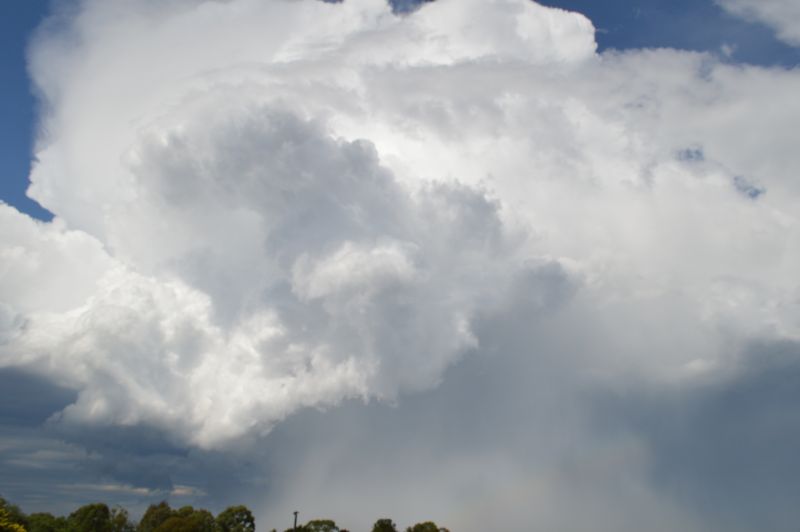
As the storm passed further east, I was mesmerized by the western side. A spectacular cumulonimbus cloud tower illuminated by the sun glowing white. It was difficult to look at due to the glare at times.
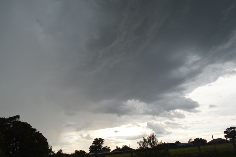
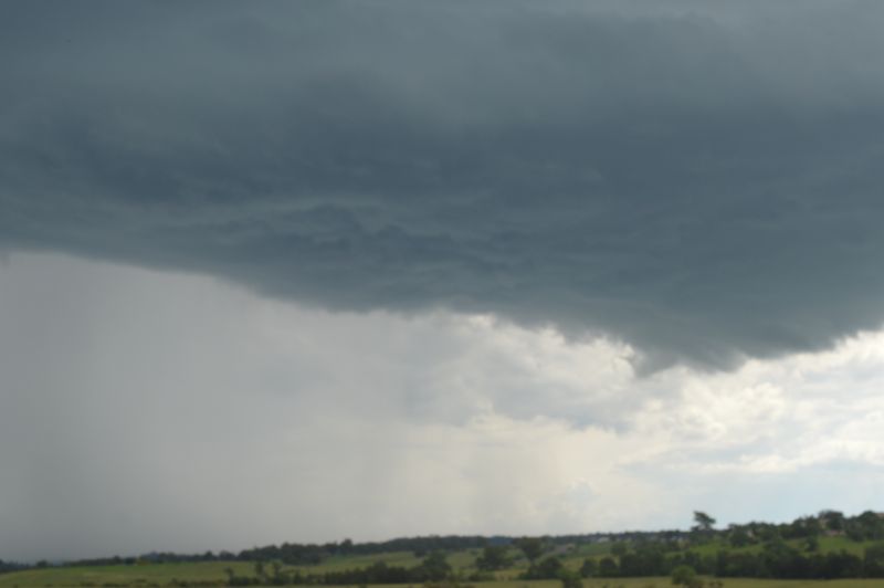
After I had taken numerous photos of this, I made my way north back towards Luddenham. I was fully aware of the main rain band / squall coming across which I was observing to the west. As I reached Luddenham a weaker thunderstorm cell developed just ahead of the main rain band / squall line and I spent some time taking photos of the base. I let the base pass overhead. When compared to the earlier thunderstorm, the storm did not produce hail or certainly no hail where I was and no cloud to ground lightning. Only sheet lightning observed within the cloud.
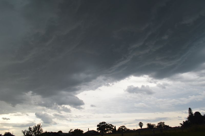
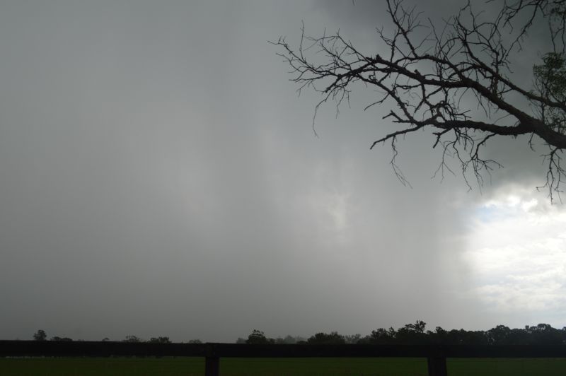
With the main squall line approaching, I travelled ahead of it and returned home in Doonside just minutes before the final squall line passed over.
For me, this was the third and final thunderstorm for the afternoon. The storm went right through Sydney and out to sea.
It brought a short period of intense rain and strong to gale force winds and a wind change that ended the storm events for the day., The system brought peak wind gusts to 76 km/h at Richmond.
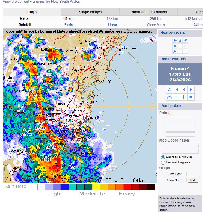
The system that passed through Sydney Thursday afternoon was the change that marked the transition to autumn. The same system passed through southern New South Wales earlier producing some thunderstorm activity and heavy showers.
It was a relatively fast moving change but it was a change which if one moved quickly and did the right forecasts, it was possible to document it with a high degree of detail.
The photos attached to the post show the Camden thunderstorm and the Luddenham thunderstorm that developed just ahead of the main rain / squall line.