During Friday February 6, a cluster of thunderstorms moved off the coast and began to rotate around a low pressure cell west of Broome (Western Australia). During Saturday February 7, the system had developed into a Category 1 tropical cyclone which was named Mitchell.
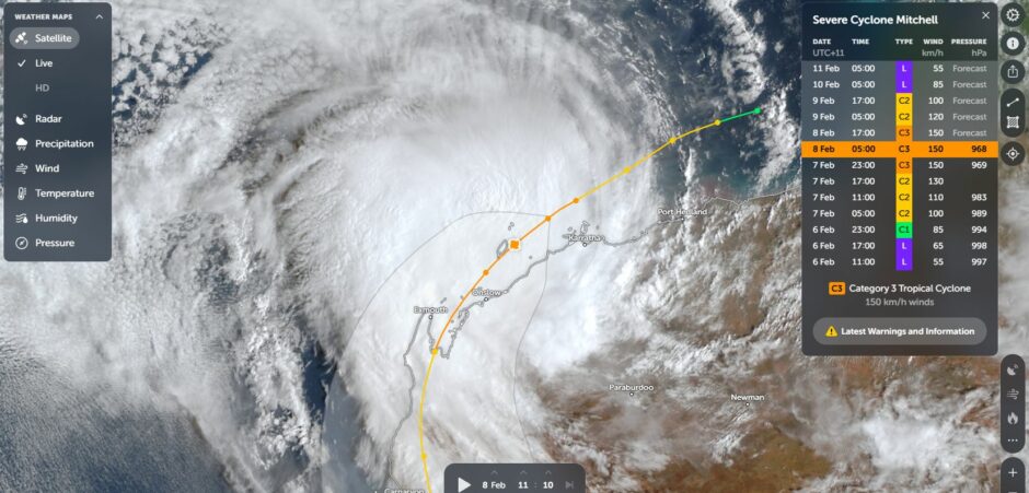
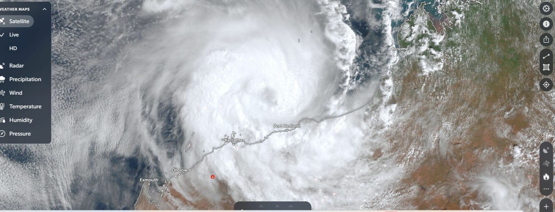
By Sunday, the storm was tracking parallel to the Western Australia coastline and continued to intensify as it moved southwest brushing the towns of Port Headland and Karratha.
That storm is now edging closer to the coastline and expected to make landfall near the towns of Onslow and Exmouth (Western Australia).
The strength of the storm is reasonably well known because the system has passed close enough to three weather stations which have accurately recorded peak wind gusts as follows:
1 – Legendre Island Weather Station – (The core passed just to the north of the island).
Here a peak wind gust to 163 km/h was recorded at 6.51 Pm Saturday evening.
Between 6.22 pm and 8 pm, regular wind gusts topped 150 km/h with sustained winds of 124 km/h.
(This would place the strength as a high end Category 2 system / skirting a borderline Category 3 strength under the Australian Tropical Cyclone Intensity Scale).
Saffir Simpson Scale – High end Category 1 / Borderline Category 2 storm.
2 – Varanus Island Weather Station – Here a peak wind gust to 128 km/h was recorded at 5.51 PM Saturday evening with sustained peak winds of 93 km/h.
(This would place the strength as a low end Category 2 system under the Australian Tropical Cyclone Intensity Scale).
Saffir Simpson Scale – Category 1 storm.
3 – Barrow Island – At 8 am Sunday morning, a wind gust to 137 km/h was recorded with a sustained wind gust to 106 km/h.
(This would place the strength as a mid range Category 2 system under the Australian Tropical Cyclone Intensity Scale).
Saffir Simpson Scale – Category 1 storm.
Further, a weather station at Karratha has recorded one single peak wind gust of 100 km/h.
To date, the best rainfall that have occurred are limited to coastal Western Australia with falls of 92.4 mm at Varanus Island and 90.6 m at Karratha.

The storm is having impacts further afield. Before the storm formed into a tropical cyclone, moisture from the system drifted southeast through Western Australia, Northern Territory, parts of South Australia and into New South Wales providing an outbreak of rain and storms across many inland regions of the affected states.
That system is now crossing the coast of New South Wales and providing light rain or showers across Sydney.
During Saturday, a narrow band of rain from the system crossed through New South Wales and provided useful falls of 20 mm to 40 mm across many parched inland regions of the state. However, areas to the north and south completely missed out. As such, the Southern Riverina, southern Southwest slopes, the southwest regions towards Victoria and areas toward the Queensland border generally received no rainfall from the event. The best falls included:
- Fowlers Gap – 74.2 mm.
- Young – 52.8 mm.
- Canberra – 11 mm to 85.8 mm (Varied according to location).
A majority of the falls that did occur fell within the range of 10 mm to 40 mm which eased a longer term dry spell.
I have attached images of the storm from NASA Zoom Earth as the system brushes the coastline of Western Australia.