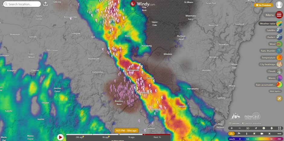
Over the weekend spanning the 31 January and 1 February 2026, two thunderstorms crossed over Western Sydney but the contrast between the two events were considerable and noteworthy.
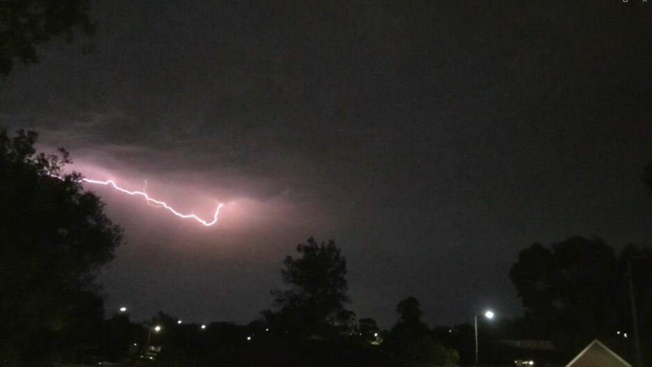
Thunderstorm Number one
Thunderstorm Number one already highlighted in an earlier post featured the following:
- Lack of any significant rainfall although a light shower did fall. Rainfall struggled to reach 0.2 mm to 1 mm and my rain gauge barely recorded 0.5 mm.
- The storm developed at the end of a day where maximum temperatures reached 36C or higher across Western Sydney.
- The storm was high based and slow moving.
- It did feature some impressive lightning flashes and cloud to ground strikes especially over St Marys and Mt Druitt areas.
- Was isolated in nature.
- Occurred late evening.
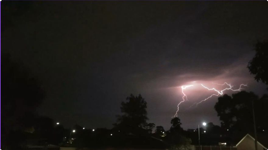
Other than some impressive cloud to ground lightning flashes that occurred, the storm would have been insignificant and not worthy to report.
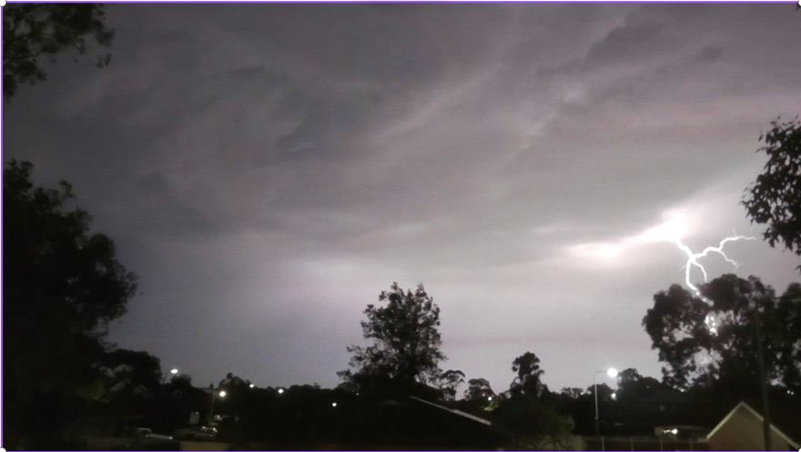
A few photos are attached.
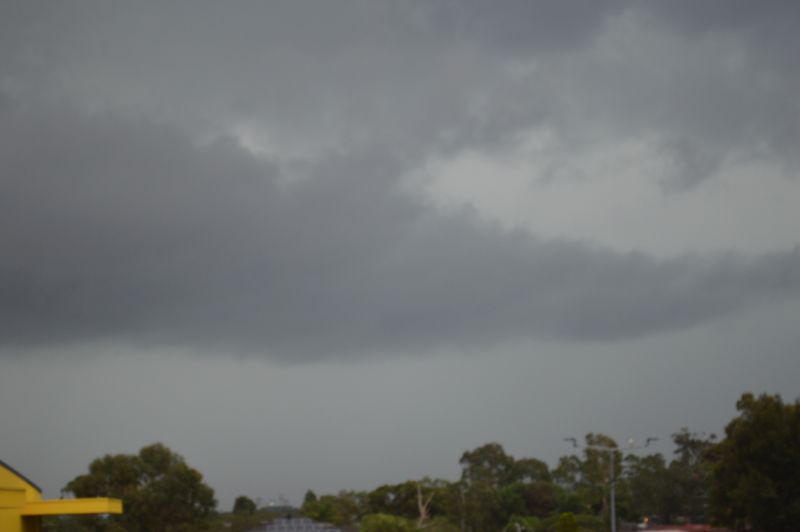
Thunderstorm Number Two
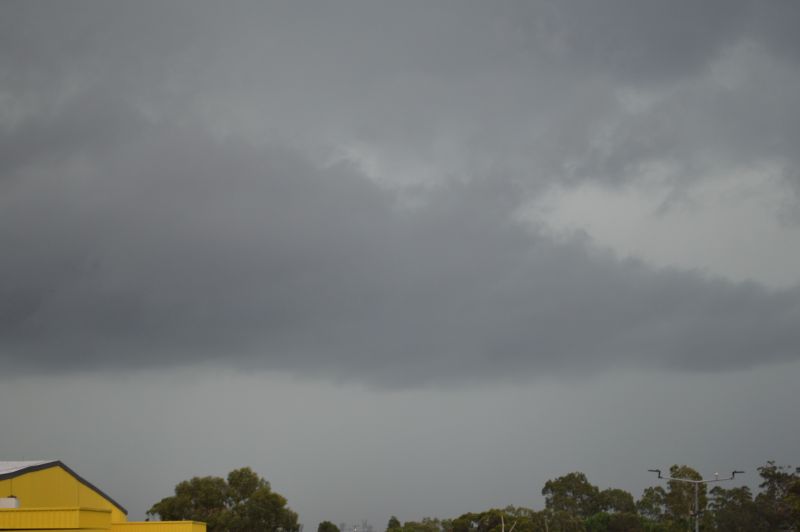
The thunderstorm of Sunday afternoon 1 February was a complete contrast to the Saturday night storm.
In particular:
- It featured some heavy rainfall with the Penrith Lakes Weather Station recording 30.4 mm from the event including 26.8 mm falling between 4.32 pm and 5 pm. My home rain gauge recorded 17.5 mm from the event as a comparison.
- Daytime temperatures were much lower having just reached 30C prior to a wind change.
- A large shelf cloud was evident ahead of the rain but it did not feature any impressive structure.
- The base was much lower than the first storm.
- It travelled at a faster rate across Sydney and acted more like a squall line.
- Very little wind observed.
- I did not see any cloud to ground lightning strikes. A majority of the lightning observed were within the cloud or known as sheet lightning. The storm may have featured cloud to ground strikes elsewhere but certainly not around Doonside as it crossed over.
- The thunderstorm was able to cross most of Sydney but it did weaken somewhat east of Parramatta.
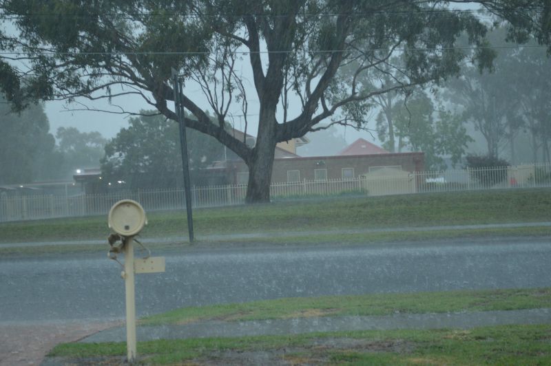
A few photos of the storm are attached to the post including the feature image. The storm was a complete contrast to the Saturday storm and this shows how storms can have different features in different weather environments.