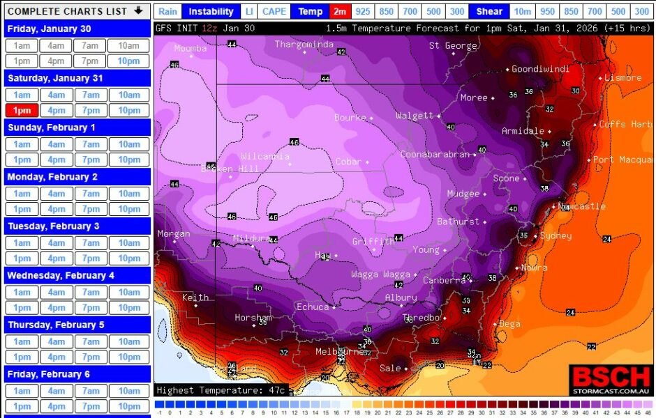
Following from the Wednesday post on this item, the heatwave gripping the inland has now reached a length of 7 days although a cooler wind change is expected late Saturday and into Sunday which will conclude the event.
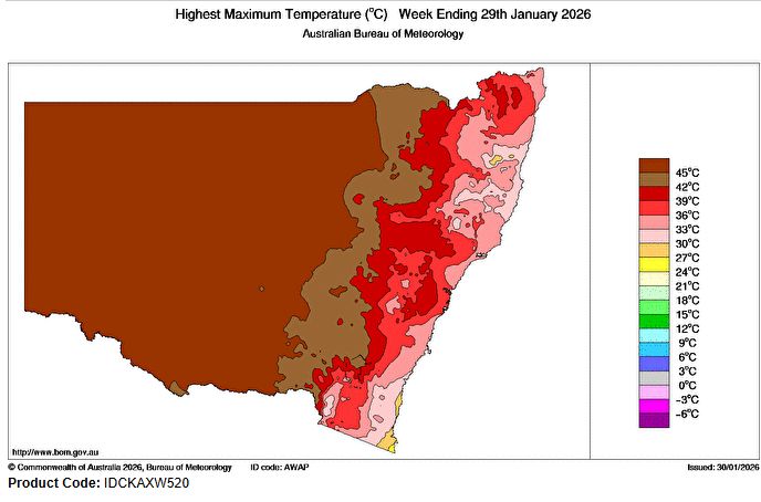
Over the past 2 days the same region has again experienced temperatures of over 40C with 47C and 48C occurring again across some inland centres.
It has also come to my attention that a small town in South Australia called Andamooka reached 50.0C on Thursday afternoon as part of the event.
Note: The town of Andamooka has experienced 8 days in a row of 40C temperatures including 7 in a row where maximum temperatures have exceeded 46C.
While this is an intense and long lived heatwave, such events have occurred in years gone by including but not limited to 2019/2020, 2018, 2013, 1987 (Which I experienced living in Albury at that time as a teenager), 1939 and those of the 1890s including the 1896 event.
In January 1896, it was suggested that Bourke experienced 24 days in a row where the temperature had exceeded 38.9C and there are reports that people were dying in the streets by January 14 of that year.
It is suggested that the temperature may have reached 46.9C at Wagga Wagga on January 7 1896. It is difficult to pin down the accuracy of some maximum temperatures of the time but even though the current event is long lived (7 days), major and intense heatwaves have occurred in the past.
Today, it is possible to travel to the inland regions in relative safety to experience what is occurring subject to basic precautions being undertaken. This is what I did during Friday 30 January.
I drove down to Wagga Wagga city and Junee regions of New South Wales from Blacktown to experience firsthand what the heatwave was like and to understand what impact it is having.
This area is located over 400 km southwest of Sydney on the South West slopes of New South Wales.
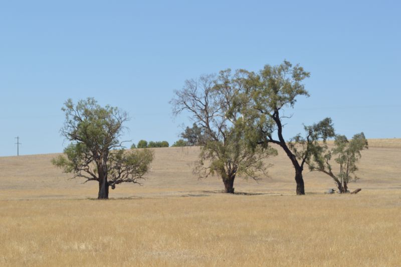
I left Sydney at 6.10 am and 3 hours later, I was within the Yass area. There appears to be a clearly defined line at Conroys Gap (650 metres in elevation) on the Hume Freeway just east of Yass. Areas further west of this, the land dries out sharply and by Jugiong (West of Yass), the ground is bone dry and as far as one can see, the hills are brown or golden yellow.
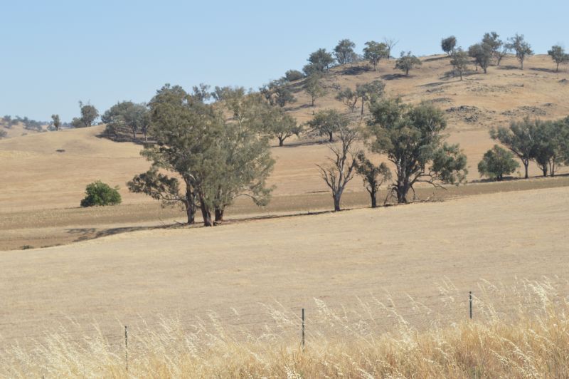
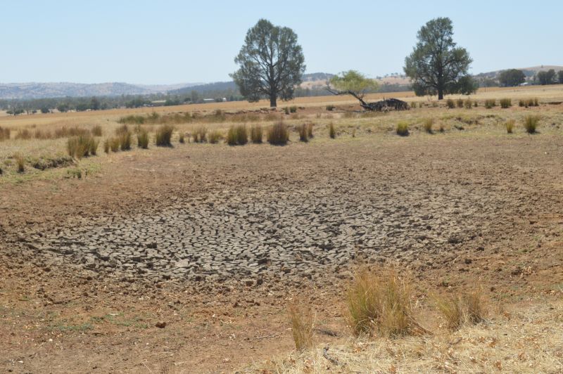
By Gundagai, it is clear that the heatwave is having an impact with dry creeks and watercourses observed. Many farm dams were observed as being dry and hillsides were bare.
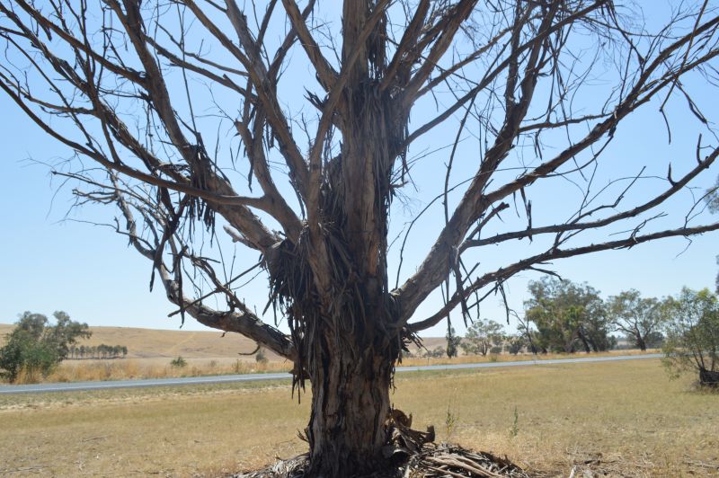
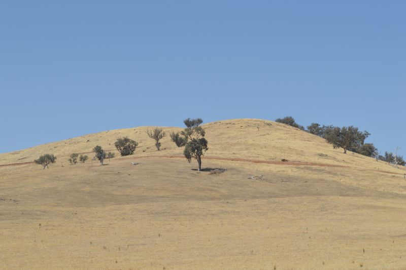
I continued onto Wagga Wagga city and it is here that the heat and dry conditions is having an impact. Trees on hilltops were seen to be in distress under the intense sun.
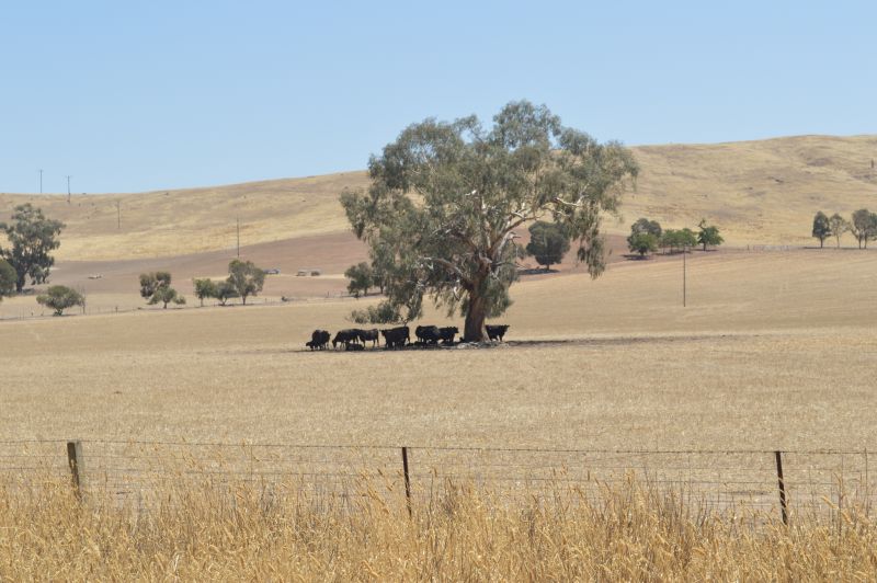
I took numerous photos of hillsides at a locality called Borambola (East of Wagga Wagga). I then drove through Wagga Wagga city then went north to Junee for a break where I found shade in town.
During this time, I found myself driving in 41C to 43C heat with the official maximum temperature recorded for Wagga Wagga on Friday being 43.2C.
Note: It has reached 44C twice this week during the event at Wagga Wagga.
I noted during this time that very few people were outdoors. In small towns, very few if any people were seen but the larger regional centre of Wagga Wagga appeared to be coping satisfactorily.
People across the inland appeared to be more resilient to the level of heat.
Despite being a major weather event, I saw evidence of resilience in which many farmers had not ploughed their farms of last years crop. As such, I was not seeing soil being blown away with the hot dry winds and it was difficult to see traces of whirl winds.
When they did occur, they did not result in large amounts of dust being lifted from farms.
The trip was done in relative safety which included appropriate breaks and plenty of drink to keep hydrated. I returned to Sydney late Friday night.
In centres such as Albury / Wodonga and Wagga Wagga and indeed across the south west slopes and eastern Riverina as a sample:
- Up until Friday, it had reached 40C on 6 days in a row with Saturday being day 7. Indeed, at the time of writing it had already reached 40C across the region making this day 7 (The final day of the event).
- It is a dry heat but during my visit, I noted brief spikes of heat with each wind gust. The wind was hot and dry generally from the north to north westerly direction.
- Little or no humidity - As such, I found the conditions manageable due to the fact that humidity levels were very low.
- Little or no cloud - Maximum heating was allowed to occur due to little or no cloud cover.
- On farms, I was observing cattle and sheep crowded under trees or anywhere where shade was available.
- I did not see as many birds flying during the peak heat of the day.
As such, despite the extreme nature of the event, I saw signs of resilience suggesting that residents across the inland areas are more prepared for such events which is a positive outcome for the region.
All photos attached to the post including the feature image of cattle crouching under a tree were taken using my Nikon DSLR 3200 camera (28 to 55 mm lens).