
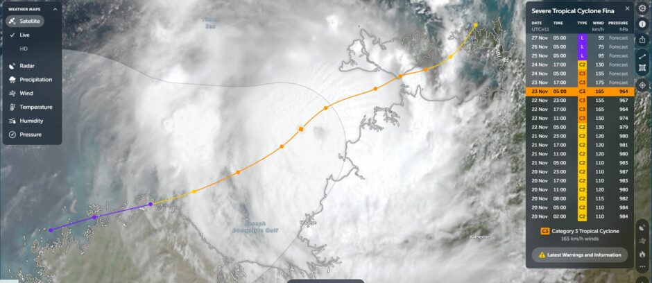
After giving the city of Darwin a glancing blow, Tropical Cyclone Fina is now retreating from the Northern Territory coastline.
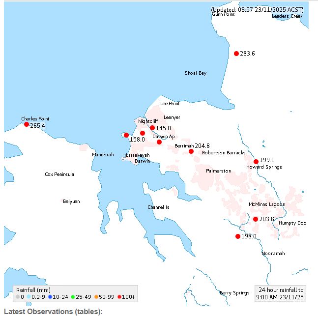
However, it has left its mark with some incredible rainfall totals for November and far in excess of what the average monthly totals that would be expected. The following is identified to 9 am Sunday morning (Northern Territory time):
- Middle Point – 430 mm.
- Gunn Point – 283.6 mm.
- Charles Point – 265.4 mm.
- Arnhem Highway (Adelaide River) – 264.5 mm.
- Berrimah – 203.8 mm
- Humpty Doo – 203.5 mm.
- Noonamah – 193.4 mm.
Darwin – Average November rainfall is 142.9 mm.
Total – 168.6 mm which is:
- The wettest day for 2025 to date.
- The wettest November on record is November 1964 where 370.8 mm fell. November 2025 has exceeded the record due to Tropical Cyclone Fina – Total so far this month stands at 433 mm across 16 days.
- Saturday and Sunday 193.6 mm of rain fell.
Flooding is certain given the exceptional rainfall totals recorded.
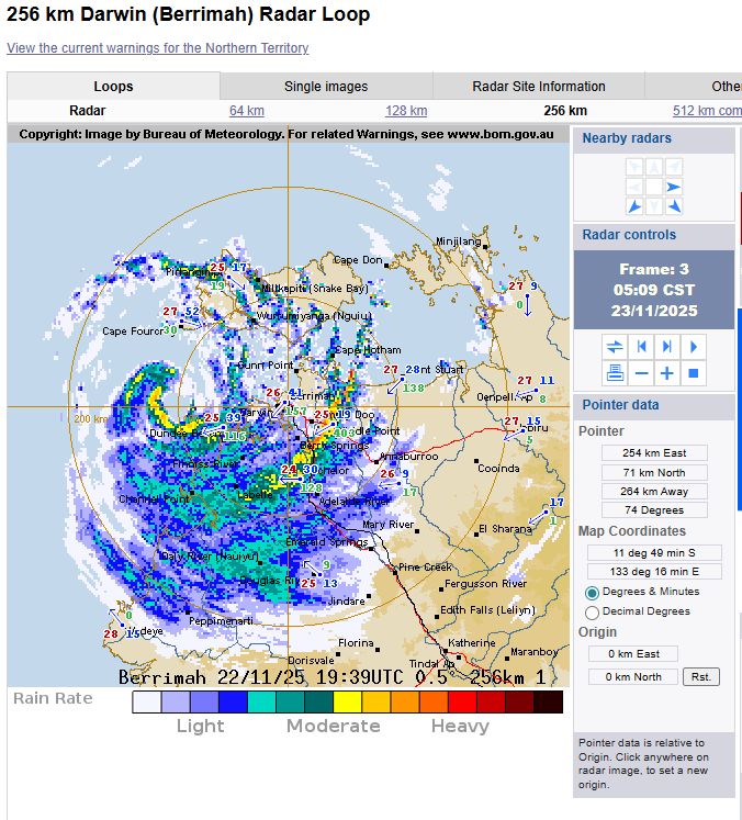
It is unclear as to how strong the winds were at the core as the storm stayed out to sea. Further:
- The eye stayed far enough north of Darwin (40 to 50 km) and thus the strongest winds would have occurred over open sea.
- There was no weather station located in the direct path of the eye.
However, there are weather stations that were relatively close to the core and while media reports suggest 200 km/h gales, this is not verified due to the eye not passing directly over a weather station.
As verified by official weather stations:
1 – Darwin – Peak wind gusts between 7 pm and 8.30 pm reached 93 to 96 km/h.
2 – Gunn Point – A peak wind gust of 104 km/h recorded at 2.30 pm Saturday.
This is consistent with peak wind gusts recorded at other nearby weather stations.
While stronger gusts may have occurred, official data cannot be sourced.
After passing to the north of Darwin between the Northern Territory land area and the Tiwi Islands, the storm is now moving further out to sea but closer to the Kimberley region of Western Australia where it is set to intensify further to a Category 2 system under the Saffir Simpson Scale (Category 3 system under the Australian Tropical Cyclone Intensity Scale 1989) before weakening as it makes its final landfall. The storm is expected to end its lifecycle as it makes its final landfall in coming days.