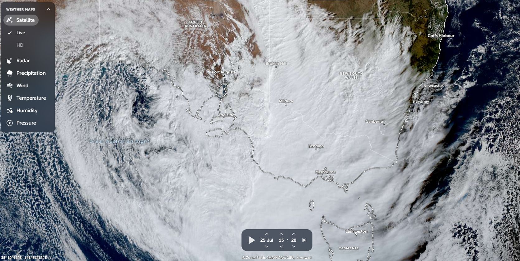
The Zoom Earth satellite photos provided by NASA Friday and Saturday 25 and 26 July 2025 shows a significant cloud mass passing across the whole of southern and eastern Australia. Weather models ahead of this were at times suggesting a reasonable rain event to occur with the cloud mass.
However, what some models were showing and what actually occurred was somewhat different.
The most significant cloud mass in months did not produce as much rain as some models suggested and the good rainfalls that occurred were patchy at best.
Much of the cloud mass comprises of cirrus, cirrus stratus cloud and an embedded but narrow rain band elongated north to south marking the thicker nimbostratus cloud. In addition, the cloud mass lacked any thunderstorm activity or embedded thunderstorms.
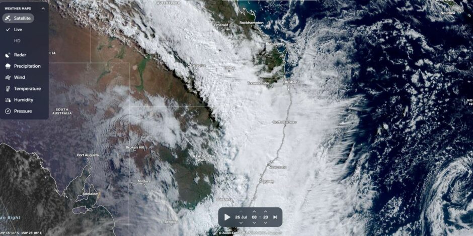
In addition, the cloud mass was fast moving which also limited rainfall potential especially for inland New South Wales.
There were some use fall rainfalls especially around Adelaide where 20 mm to 65 mm fell with the higher totals falling across the Adelaide Hills and ranges to the east and northeast of the city.
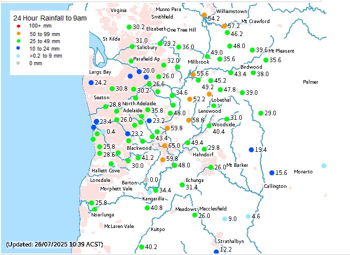
For Adelaide, this was the best rainfall event for 2025 but such falls were not enough to have much impact upon the rainfall deficiencies occurring or drought conditions impacting the wider region.
Across Western Victoria, some use fall rainfall occurred with some centres receiving helpful totals within the range of 20 to 30 mm. The best totals include:
- Yaapeet – 30.4 mm.
- Nhill Aerodrome – 28.4 mm.
- Bendigo Airport – 28.2 mm.
A few very isolated higher totals occurred including:
- Mt William – 58.2 mm.
- Stawell Aerodrome – 31.8 mm.
The higher totals fell in a band approximately 100 km wide. North and south of that, rainfall was much lighter within a band of 5 to 10 or 10 to 20 mm. For Melbourne, very little fell with only some regions of the city receiving 1 to 2 mm.
A few very isolated totals of 30 to 50 mm fell across Northeast Victoria including:
- Lake Buffalo – 54.4 mm.
- Mongans Bridge (Kiewa Valley) – 40.2 mm.
For the most part, rainfall was much lighter and disappointing.
Mildura received 19.2 mm which is the best fall to date for 2025. This is significant as this takes the yearly rainfall tally to date to only 69.3 mm or 87 mm since December 1 2024.
Across New South Wales, isolated 20 mm totals fells around Coonabarabran including 28.8 mm at the local airport but for the most part, falls across the northwest slopes and plains ranged between 15 and 20 mm.
Across the southwest part of the state, falls were within the rage of 5 to 10 mm with some 15 mm totals occurring.
Generally, for such a large cloud mass, totals overall were not too significant and for the drought affected regions of the south, the event would have only given limited assistance.
While further showers or light rain is expected across the southern regions in coming days, rainfall will be patchy and hit and miss events.