

There have been a number of hurricanes this season within the Atlantic Ocean but as usual, they have mainly affected oceanic regions within the tropics or regions adjacent to the tropics. So far this season and notwithstanding recent flooding events across Louisiana and southern United States, the United States has not been affected by such storms to any degree.
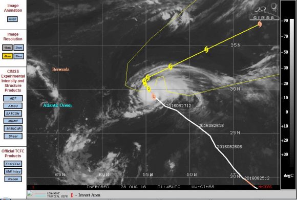
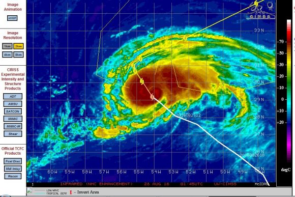
A tropical storm at latitude 30 degrees north and longitude 54.6 degrees east within the mid Atlantic Ocean has transitioned into a small hurricane. This is unusual as the development has taken place well north of the Tropic of Cancer. What makes this storm even more unusual is its suggested forecast model for the next two days. The CIMSS forecast model suggests that the storm will remain at hurricane strength even at latitude 35 degrees north.
The storm is expected to reach peak intensity within 2 days with forecast winds to reach 90 knots at the centre (Approximately 167 km/h) as a Category two system on the Saffir Simpson Scale. The storm is well supported by sea surface temperatures of 29C to 30c even this far north. Given the right environment, the storm is capable of being sustained. Waters of 28C are reaching as far north as 37 degrees north of the equator within the region.
This is only a small hurricane but there is clear convection occurring at or near to the core although an eye cannot be seen. The storm is expected to track north west then be steered more to the north east as a weakening hurricane as it approaches 37 degrees north.
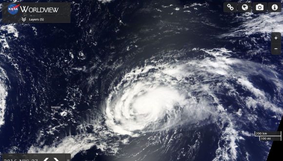
The satellite photo of the storm from NASA Worldview shows the storm clearly with convection visible. The storm is expected to remain over open ocean during its life span as a hurricane and thus not affect a population centre.
CREDITS
CIMSS Forecast model of the storm acquired 27/8/2016.
NASA Worldview of the storm with overlays acquired 27/8/2016.

Hurricane Gaston is now a much weakened storm but before it did, it reached Category 3 on the Saffir Simpson Scale. This is remarkable as it achieved this 33 degrees north of the equator or around 10 degrees north of the tropics. The CIMSS model plots shows the storm at peak intensity with a well defined eye. This is unusual but conditions favoured its development at such a location. The storm is now tracking north east towards Europe and continues to weaken as it has encountered colder waters.