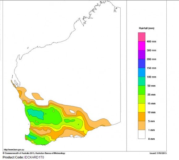
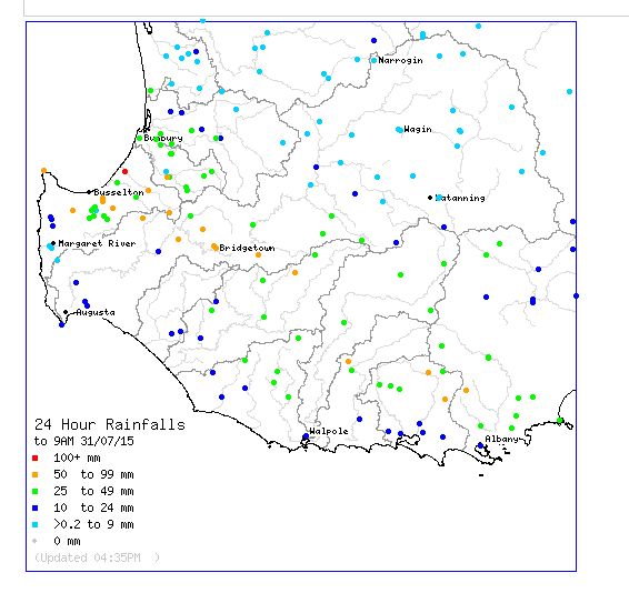
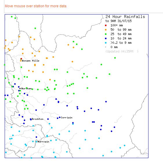
A significant low pressure cell over south west Western Australia has delivered some significant rainfall for the period 30 to 31 July 2015. Rain and thunderstorm activity has been a feature for the south west with the system producing rain well inland all the way to Kalgoorlie / Boulder.
Interestingly the city of Perth has largely missed out with the heavier falls falling to the north and to the south of the city. In some instances, rain and storms have been training over an area resulting in some places receiving more than one storm event.
Generally the city of Perth received between 10 and 27 mm of rain for the 24 hours to 9 am 31/7/15.
However isolated totals in excess of 100 mm has been a feature of this event especially in areas that have not seen such rain for considerable time. The heaviest totals for the 24 hours to 9 am 31/7/2015 are:-
Cahel North - 118 mm.
Wongan Hills - 100 mm.
Bindi Bindi - 94 mm.
Jarrahwood - 93 mm.
Somme Creek - 93 mm.
Bridgetown - 86 mm.
Gabbin - 82 mm.
Mindalla - 76 mm.
Anro 75 mm.
Westbourne - 74 mm.
Many other centres in the affected area have received more than 50 mm of rain from the event. Some of the area is also a wheat belt cropping zone and farmers are celebrating the rains as this will assist the area greatly.
Late 31 July, the rains had extended well inland as far as the desert regions around Kalgoorlie / Boulder with falls exceeding 20 mm by 8 pm. When reviewing some local weather stations, it is clear that some reasonably intense falls are occurring in short bursts but generally rainfall is steady and long lived in duration.


Has their season Harley Pearman been higher than average? They were screaming drought upon drought in previous years? I know that traditionally they rely on northwest rain bands for rainfall which has been occurring this winter possibly due to the onset of the Indian Typhoon sending jets stream cloud bands that intensify as they hit colder air.